
If you do business with us, you have to pay the river.
—John Bezdek, lead counsel, Colorado River Indian Tribes, June 4, 2026
I. The Question
Anyone could submit a question to the shared queue, and the room—full of people whose profession is managing the Colorado River: water lawyers, state negotiators, tribal leaders, water engineers, and hydrologists—had voted mine to the top. There it was on the screen in the courtroom of the Wolf Law Building at the University of Colorado: How can a Rights of Nature framework be reconciled with Prior Appropriation?1
John Bezdek, lead counsel for the Colorado River Indian Tribes (CRIT), paused. He had just presented CRIT’s personhood resolution, which, in a unanimous vote in November 2025, declared the Colorado River a rights-bearing entity under tribal law—the first such declaration for the river.2 CRIT holds the most senior water rights in the Lower Basin, established by an 1865 Act of Congress signed by President Abraham Lincoln. CRIT’s seniority is probable rather than confirmed—nearly certain, never judicially settled—as no court has ranked every claim in the basin.3 Under Prior Appropriation, seniority is everything: during a shortage, senior rights have priority. Other parties need those rights, and when they come to CRIT, CRIT can set conditions for accessing those rights. “If you do business with us,” Bezdek said, “you have to pay the river.”
His answer did not reconcile the two frameworks. It could not. “Prior Appropriation” treats water as property, as divisible, quantifiable, allocable in advance of any actual rain, mortgage-able to urban growth that does not yet exist. It is a technology of scarcity: it assumes a fixed quantity, ranks the claimants, and administers the shortfall. The “Rights of Nature” framework treats water as a living entity with inherent rights to exist, flourish, and regenerate. It begins instead from sufficiency: from a river whose continued flow is the precondition of everything drawn from it.4 Robert Macfarlane calls river rights “the commonest form of novel legal subjectivity in dozens of countries around the world.”5 One framework holds the river as an object to be divided. The other holds it as a subject that cannot be.
The Colorado River basin’s scarcity was not an accident of nature. It was authored, on paper, in 1922, and that document, the Colorado River Compact, remains in force. The premise originated in the nineteenth-century’s Manifest Destiny. In 1878, the US geologist John Wesley Powell, who had led the first federally sponsored descent of the river’s canyons, told Congress that the arid West could be settled only at the scale of the water actually available, rather than the water that settlers wanted.6 His surveys were instruments of theft: the same campaign of measurement that produced his warning also mapped the basin for settlement, and Powell co-authored the federal report recommending that the Indigenous peoples of the region be confined to reservations. Congress rejected his limits but kept his premise: the West as land and water waiting to be measured and claimed by the United States.
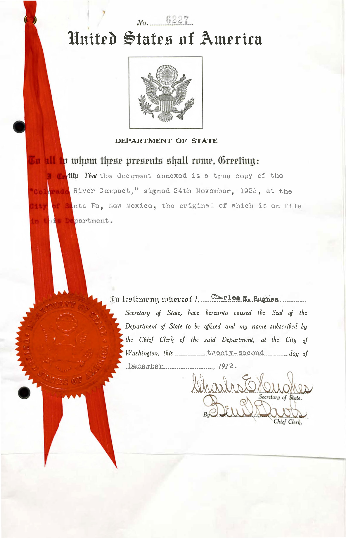
The river runs 1,450 miles from its headwaters in the Colorado Rockies to its delta in Mexico, where it no longer reaches the Gulf of California. It waters forty million people, thirty tribal nations, and the farms that grow most of the continent’s winter vegetables, all while carrying a third less water than the document governing it assumed. The headlines call this drought, conflict, and shortage, as if the river had failed the cities. The opposite is true. The cities—Phoenix, Tucson, Los Angeles, San Diego, Las Vegas, Albuquerque, Denver, Salt Lake City—mostly predate the Compact, but each was remade by it: by the dams and aqueducts of the 1930s and 1940s, by the postwar boom, and by the arrival of the Central Arizona Project in the 1980s and ’90s, each scaled to volumes the river could never deliver. That guarantee could finance any settlement, justify any dam, postpone any Indigenous claim. The scarcity manufactured growth: Phoenix and Los Angeles now spill past their own limits into regions no municipal boundary contains. It also manufactured deficit. A finite, living desert river was converted into an infrastructure that could never be allowed to run dry, and the shortfall was assigned, in advance, to the people the law was written to exclude.
Back in the Wolf Law Building, no one in the room needed to be told the river’s accounting had failed. Brad Udall,7 a climate scientist, had opened the morning with a chart of the running ten-year flow at Lee’s Ferry, the gauging station fifteen miles below Glen Canyon Dam, in Arizona, that the 1922 Compact installed as the hinge of the entire legal system. The sum was falling toward 82.5 million acre-feet, the line below which, by the Lower Basin’s reading, the Upper Basin would fail its obligations to the Lower Basin and Mexico; the Upper Basin disputes that it owes that much. If the figure remained below that threshold at the end of the water year on September 30, the trip wire could be triggered. Past it lies a Supreme Court fight over compliance with the Compact—a fight officials already call one where everybody loses.8
Two decades of aridification—the worst dry spell in the tree-ring record in 1,200 years—were bringing a document that had never accurately described the river to begin with into contact with a century of induced warming, accelerating toward collapse.9 The post-2026 operating guidelines that will govern the river for a generation have been under negotiation since 2023; the states missed their own November 2025 deadline, and the Department of the Interior drafted the guidelines instead.10 There was no single table. There were two: the Lower Basin negotiating as one bloc, the Upper Basin as another, neither willing to bind itself to cuts the other might not match. The question surfaced in a room whose occupants had built their careers inside that failing system.
This question extends from the courtroom to the cities that drink the Colorado, each built on an understanding that the river is an object to be divvied up. What would architecture become if it instead understood the river as a subject—a living, pulsing body to which it owed attention? That body is failing. Bled for a century to build the Southwestern US, and now fevered by a warming planet, the river dies in the sand, short of its sea.11
II. Lords of Yesterday
The Wolf Law Building sits on a campus that models the whole system of manufactured deficit in miniature. The University of Colorado was founded in 1876, five months before Colorado became a state, on land taken from the Arapaho, Cheyenne, and Ute peoples under treaties the United States government broke almost as soon as it signed them. Each nation continues to press claims to the land that the university now occupies.12 Its lawns are kept green by gravity-fed ditches drawing water secured through Prior Appropriation as the people who lived there were removed.13 A Tuscan-style campus, sustained by a river made to run across the continental divide, its green lawns a fiction of abundance on dispossessed, arid shortgrass prairie. The conference met inside it.
A generation ago, the laws that govern this basin were called the “lords of yesterday,” the instruments of nineteenth-century US westward expansion that, despite the transformation of every surrounding context, were never revised.14 Mining claims. Grazing rights. Prior Appropriation. First in time, first in right, written by men aiming to colonize a desert. These are inherited rules, renewed continuously by an apparatus of measurement and surveillance—satellites that read the evapotranspiration of every field, gauges and meters that count each acre-foot, and forecasting that sets whose water is cut—the old power to make live and let die refitted with sensors and software.15 And the task, for anyone who wants the deficit ended, is not to counsel them but to depose them. Yet every instrument of water reform—leases that move senior rights to cities, payments to fallow fields, ever-finer forecasting and engineering, cloud seeding, desalination—is negotiated within their terms, and each one leaves them on the throne. Reform operates within the ontology of the doctrine it reforms, and so it cannot do what the situation requires, which is to topple it. Police “reform” fails for the same reason. Prison “reform” fails for the same reason.16 The deficit these instruments produce, cities built forever short of the river, is not a problem inside the system. It is the system. You do not fix it from within. Off with their heads.
The final afternoon of the conference gathered three elected leaders of sovereign nations—Chairwoman Amelia Flores of the Colorado River Indian Tribes (CRIT), Chairman Selwyn Whiteskunk of the Ute Mountain Ute Tribe (UMUT), and Governor Stephen Roe Lewis of the Gila River Indian Community (GRIC)—onto a single panel. What is revealing is not that the organizers made this choice but that it was nearly invisible to the water lawyers, negotiators, and engineers who filled the room. Property and identity in the West are forged in the same act, through the foreclosure of a prior claim. The water right is made by canceling the claim that was actually first, and the settler is made by filing a new one in its place. The same act turns distinct nations, with distinct treaties and losses, into one category, ready to be scheduled onto one panel.17 Each nation’s claim was canceled by a different piece of infrastructure, and a settler society was then built upon each. Flores’s CRIT holds an 1865 priority date that Los Angeles’s Colorado River Aqueduct and Phoenix and Tucson’s Central Arizona Project were built to outrun rather than honor. Whiteskunk’s UMUT holds an 1868 treaty right on the Mancos River, yet nearly a century later, Colorado gave the Dolores Water Conservancy District priority over it through the McPhee Reservoir. Lewis’s GRIC lost the Gila in 1889, when the Florence Canal Company cut the river off above it. Each foreclosure produces the same waste—land and sovereignty taken, fields gone to dust, aquifers desiccated and poisoned, intergenerational trauma—that the system files outside its ledger, the way an economist files an externality outside the price. That the room did not see this is a measure of how total Prior Appropriation has become.
The panel met in a thinning room, an emptying that mirrored 1922, when not one of the tribal nations with rights to the river sat at the table. The Compact provided for three claimants: an Upper Basin, a Lower Basin, and Mexico. Tribal rights were older than any of them, recognized by Winters v. United States in 1908. The Compact’s drafters deferred those rights in a single sentence in Article VII, and that deferral is how the system still balances, moving water owed to senior Indigenous rights into the growth of the cities. A century later, the conference schedule largely reproduced that deferral.
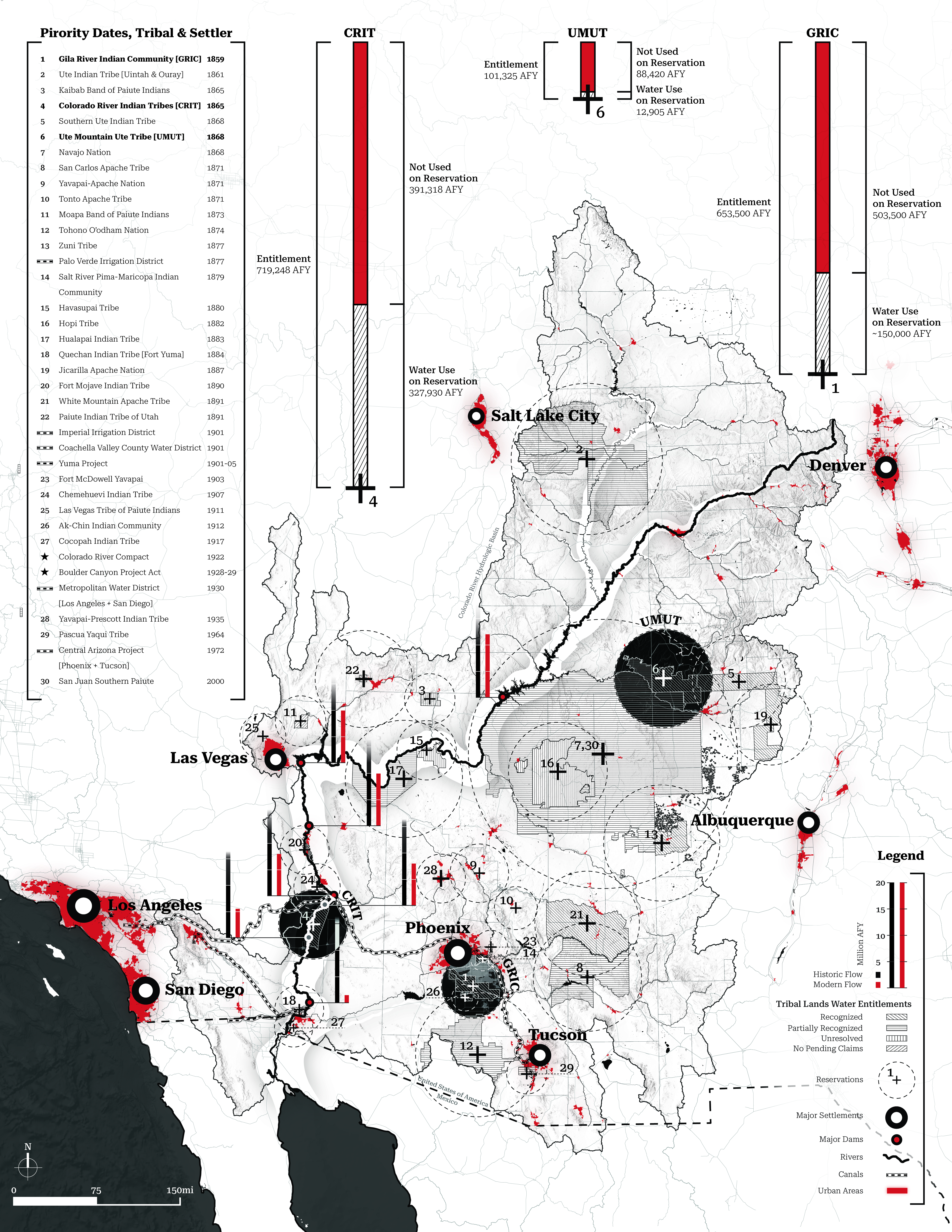
Chairwoman Flores opened with a creation story. Her Mohave ancestors knew the river before any doctrine governed the water; their creator, Matavilya, sent the birds to carve the river’s bends and crossings. “The Colorado River defines us,” she said. “We don’t define the river.” CRIT consumes barely half its legal entitlement, because the US Bureau of Indian Affairs has failed to provide the irrigation infrastructure needed to access the rest, leaving that water to junior appropriators free of charge while a third of CRIT’s land lies fallow.18
Chairman Whiteskunk shared that upstream, UMUT’s farms ran on 14 percent of their normal water supply in 2026, while their sacred springs went dry.19 The deferral is not incidental. The over-allocation of 1922 could function only by holding tribal entitlements in permanent abeyance; the arithmetic of the system depends on senior Indigenous rights not being fully delivered.
Governor Lewis spoke of GRIC as the water user most at risk in the basin. His ancestors, the Akimel O’odham, People of the River, farmed the Gila for more than two thousand years until settlers diverted water at Florence, upstream of the reservation, starting in the 1870s. The 1877 Desert Land Act let any settler claim 640 acres by digging a canal to reach it, and by 1880 there were already too many claims for the river to satisfy; the Florence Canal Company’s 1889 diversion, described at the time as the decisive blow, took what little remained.20 The diversions did not merely shrink the harvest. They ended it. The fields cracked and blew away. With the river gone, an epidemic of Type 2 diabetes took hold in the 1890s and never let go. In some cohorts it has run past fifty percent. A line of law cut the water; the dry channel brought famine; the famine rewrote the metabolism of a people; and the wound remains open in living bodies a century and a half later, in amputated feet and failing kidneys and children born already inside the injury.21 The Ancestral O’odham canals beneath this history, dating back two millennia, are the “sacred fingerprint,” in Lewis’s phrase, on which Phoenix now stands.
This is what the Law of the River does. And yet Lewis’s words fell on a half-empty room, at a conference named for two men who spent their careers fighting the framework that set those speakers at that hour before those empty chairs. Many who left were not indifferent. They were working within an ontology that had already filed these claims as peripheral to the problem they came to solve. That is not simply a moral failure. It is the system working precisely as designed.
This system extends beyond the room. Eleven weeks after the conference, on August 21, 2026, the Bureau of Reclamation finalized its preferred alternative for post-2026 operations; the guidelines took effect on October 1. The decision followed months of public process, hearings, comment periods, and state-by-state negotiation, and none asked the question this room had: not how to divide the river, but what it is. The choice made in its absence will shape city growth, farm buyouts, and tribal deferrals for a generation—arguably the most consequential act of urban planning now underway in North America.
III. The Law of the River
“Law of the River” is the US Bureau of Reclamation’s own term for the sprawling, deliberately opaque legal architecture governing every drop in the basin—encompassing a century of compacts, treaties, and litigation that treat the river as an object to be divided rather than a body to be kept alive.22 Beneath these different instruments is a single governing logic: Prior Appropriation. First in time, first in right.
The doctrine converts a river into a ledger of quantities and priority dates. And it decides who may hold entries, prioritizing those who filed first through a bureaucratic registry that was built to facilitate settler claims while excluding the nations whose relationship to the water preceded its first entry. As the Diné geographer Andrew Curley writes, western water law is “a machinery of dispossession” now targeting “the last great commons of North America, inherent Indigenous relationships with water.”23
The US federal government made it all possible. The Reclamation Act of 1902 financed irrigation works and dams from the sale of western public lands, explicitly to “reclaim” arid land and make, in the era’s language, “homes for Americans on family farms.”24 Every Reclamation project that followed was a subsidized act of Prior Appropriation at the scale of infrastructure, public money building the mechanism of private water rights, until one in five acres of irrigated farmland in the western United States drank Reclamation water.25 This was and is not a market. It was and is a massive welfare state organized around a property doctrine, using subsidized public money to deliver land, water, and identity to one population while excluding others through the same instrument.26 What rose on that subsidy are settlements permanently in deficit, sprawling megalopolises living beyond the river’s means, held up above the shortfall by federal money and Indigenous deferral. The deficit is not a recent failure of the system. It is the oldest and most faithful product of it.
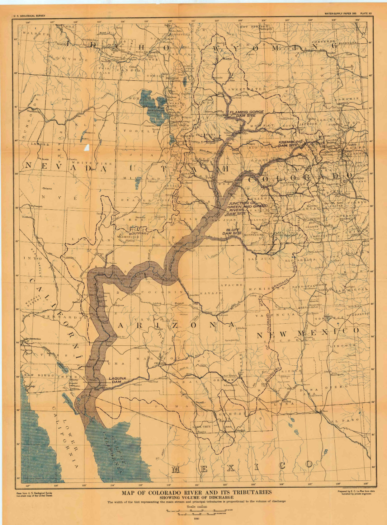
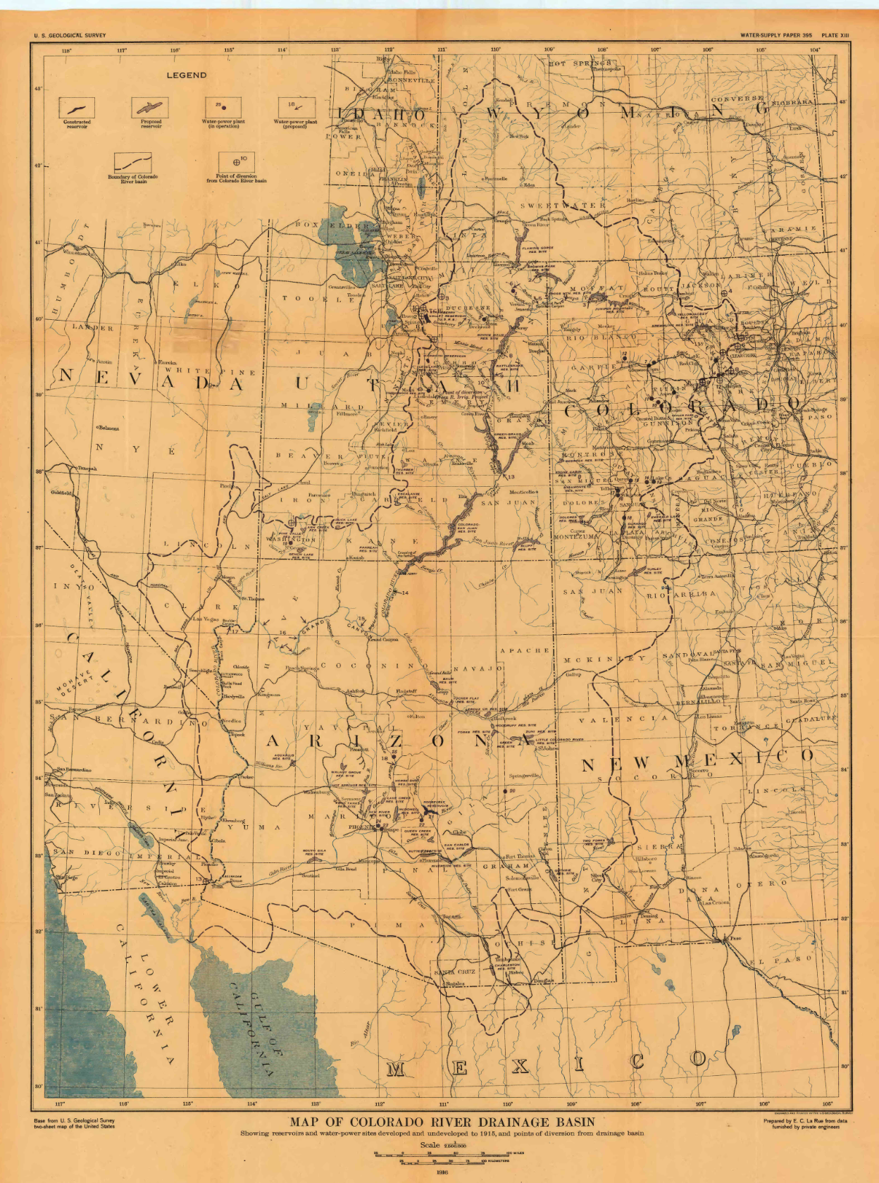
The cities of the southwestern US give built form to this deficit. They exist in part because Prior Appropriation allocated water that made their growth bankable, and forty million people now carry identities premised on that allocation and the alienation that preceded it. The Central Arizona Project, 336 miles of canal completed in 1993 at a cost of $4 billion, did not serve Phoenix; it helped bring Phoenix’s current scale into being.27 Urbanization and the doctrine are one artifact at different scales. This is paper water, a legal fiction given a body in concrete and asphalt and lawn, and now in server racks and clean rooms, a built form of rights to water that was never there.28
The canal carrying the Central Arizona Project’s allocation loses roughly 75,000 acre-feet a year to evaporation and seepage before it reaches a single tap.29 Golf courses across Maricopa County use another 98,000, more than any other county in the country.30 Beneath it all in Phoenix, 7,000 miles of water main, much of it laid in the postwar suburban boom the Reclamation Act financed, now breaks roughly four thousand times a year.31 This waste is what the fiction looks like once it has had a century to calcify into infrastructure.
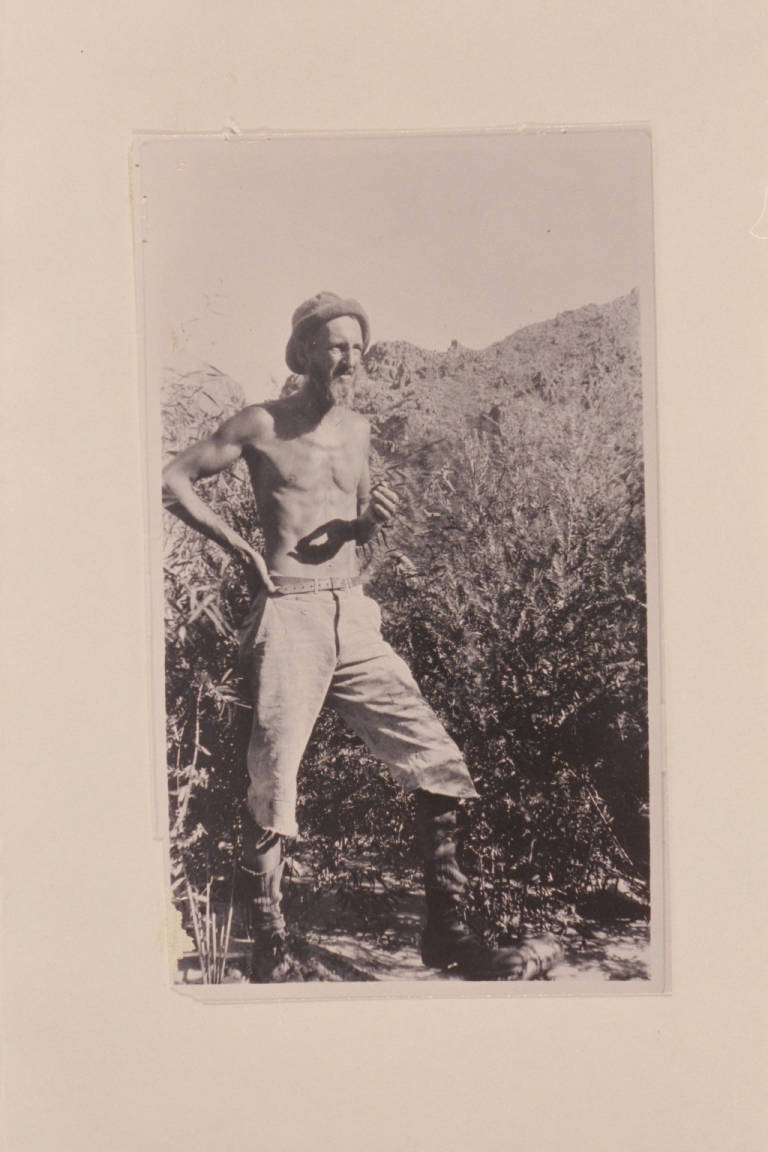
The over-allocation was not an accident, and it struck the river’s delta and living tributaries first.32 The 1885 Arizona Canal and the 1911 Roosevelt Dam, one of the first federal Reclamation projects, captured the Salt River upstream of the Onk Akimel O’odham and the Xalychidom Piipaash; diversions at Florence took the Gila River from the Akimel O’odham. All three peoples were confined to two reservations that went dry so that Phoenix, and the farms around it, could grow. In 1916, the hydrologist E. C. LaRue put the shortage into the federal record in the US Geological Survey’s founding study of the basin—the agency Powell had once directed—cataloguing why his own numbers were likely too generous: diversions the gauges never recorded, evaporation never subtracted, an irrigation economy already narrowing the river before he finished measuring it.33 Six years later, he warned the Compact Commission that there was not enough water for the allocations under discussion, and was ignored. The Compact was negotiated with the arithmetic that refuted it already on the table. The Hoover Dam closed its gates in 1935; after the Glen Canyon Dam followed in 1963, the delta’s wetlands and riparian forests shrank to roughly 5 percent of their historic extent, and its Gulf fishery collapsed within two generations. The dominant world of the southwestern US was built on a known fiction, kept alive because it enables dispossession, even as it kills the river. That construction is still ongoing.
The same Reclamation subsidy also built a food system and the megalopolis of Phoenix, both now devouring themselves. The river feeds the cultivation of most of the continent’s winter vegetables with the labor of predominantly Latino and Indigenous Mexican farmworkers in the Imperial Valley, workers excluded from the property system their labor sustains.34 Weapons manufacturers, data centers, and subdivisions now expand so far past the city’s edges that “Phoenix” no longer names anything geographically coherent. As the system degrades, the failure arrives unevenly in food, air, and health. The communities who grow the vegetables also breathe the toxic dust that rises from the receding Salton Sea, where child asthma rates are among the highest in California. Grocery inflation, felt everywhere, is only the most legible edge of the cost. The rest is paid at the scale of the cell, in lungs, blood, and bone, over the longue durée of degradation, by every body in the basin; wealth buys distance from the damage, not exemption from its effects. But the injustice has never been distributed evenly. It arrived first, and in full, for Indigenous farmers whose rivers were taken; for Mexican, Indigenous Mexican, and migrant farmworkers who harvest the Imperial Valley; and for Black and Mexican American neighborhoods in South Phoenix beside the city’s industrial zones.35
This is where the notion of crisis fails. A crisis is a deviation from a normal that is expected to return. What is underway in the basin is continuation, the founding fiction, finally legible to the culture it built. The deficit has been managed since 1922 by escalating federal subsidies—dams, canals, cloud-seeding generators—and the subsidy has not stopped, it shape-shifts. In 2025, the Trump administration froze $4 billion in conservation funding that had already raised Lake Mead fifteen feet; more than a year later, a fraction of it, $47 million, was finally released. In the same period, the administration announced $889 million for water infrastructure elsewhere in the West, not one dollar of it inside this basin.36 The deficit is managed by choosing which subsidy to escalate and which to starve, and the continued deferral of Indigenous water obligations is consistent. Both will intensify as the hydrology worsens, because the system can balance its books in no other way: by subsidizing the gap and withholding what it owes the senior rights-holders it was built to exclude. Each instrument buys dwindling time. The fiction does not change: here or anywhere else, water has been promised past its supply.37
IV. Apples and Oranges
The CRIT resolution, designating the Colorado River as a legal person, rests on two earlier instruments—a 2022 federal act granting authority to lease and conserve water off-reservation and a tribal water code—which together do what no Prior Appropriation instrument can. They make the river a party. Not a quantity at a gauging station, not a property claim, but a party, with interests and standing under tribal law.38 Legal personhood is not a new concept. Boeing, Northrop Grumman, Intel, TSMC—among the largest consumers of water in Phoenix—are all persons under the law.39 The CRIT resolution—brought by the Mohave, Chemehuevi, Hopi, and Navajo people who make up the tribes—does not fabricate a subject to protect property. It recognizes one, so a living river cannot be reduced to a diversion point in someone else’s ledger. Anisa Patch, a council member central to the resolution, described its foundation: “In our culture, the river is precious. We’re supposed to be the stewards of these gifts from our creator. It’s in the stories.” Personhood makes those values legally enforceable. “We want to have a stake in the ground to stand firm on.”40
Daryl Vigil, co-chair of the Water and Tribes Initiative, named the incompatibility directly. Reserved water rights, the kind that tribes hold under the Winters Doctrine of 1908, are not the same legal animal as a beneficial-use right under Prior Appropriation. “It’s apples and oranges,” he said. “And it’s impossible to come to a solution with apples and oranges.”41 Reserved rights carry the reservation’s founding date, making them senior to nearly all other claims, and cannot be lost through nonuse. Yet tribal allocations remain deferred, through Prior Appropriation. Andrew Curley calls these water settlements “colonial enclosures”: Indigenous water translated into the quantification logics of western law.42
Vigil’s apples and oranges is Curley’s colonial enclosure named from inside the room. Conservation programs and demand-management ledgers already perform that enclosure, translating a reserved right into a volume that can be banked, bought, or leased. In 2021, CRIT agreed to leave 150,000 acre-feet in Lake Mead for $38 million, fallowing more than fifteen square miles of reservation farmland to do it. A year later, the federal act on which the river’s personhood would come to rest authorized CRIT to lease part of its allocation off-reservation, including to greater Phoenix.43 Both transactions take a right older than the state that measures it, grounded in a relationship to the river rather than to a volume drawn from it, and re-express it as an acre-foot figure a spreadsheet can hold. The ledger cannot hold that right’s real seniority. It can only defer the entitlement and paper over the difference: an accounting, never a reckoning.
The new operating guidelines cut the Central Arizona Project’s municipal pool by 14 percent. Warming deepens the distribution the Compact already established. For a city that draws 40 percent of its water from a river now at its driest level in twelve hundred years, officials warn that cuts could intensify over time, pushing Arizona’s allocation toward zero at each future renegotiation.44 The system does not fail and then get fixed; it requires its own failure, and that cruelty was never incidental. Prior Appropriation has worked, for a century, by deciding whose fields go dry and whose children breathe poison. Phoenix is the deficit made spatial: in its current form, it can only persist by continuing the shortfall that will end it.
This is where Ezra Klein and Derek Thompson’s Abundance, their widely discussed book that argues that much of the scarcity governing American life is chosen rather than natural, fails the basin.45 They are right that the scarcity is chosen, but they locate the choosing in the wrong place: a procedural defect, the drag of permitting and zoning, that building more could simply clear away. But the Colorado River basin has been building more for a century. Dams, canals, aqueducts, so much housing—all these are the abundance agenda already enacted, and the scarcity deepened anyway, because here scarcity was never a failure to build. It was the thing being built: a finite river converted into infinite settlement by promising water that did not exist and assigning the shortfall, in advance, to GRIC, UMUT, and CRIT—among the Native nations whom the Law of the River was built to exclude.
The abundance itself was carried off elsewhere, into Imperial Valley fields worked by the very people the property system excludes, into weapons production lines building for genocides and forever wars. The ledger was never blind. It has always known exactly whom to starve to keep the taps running in Scottsdale. You cannot build your way out of a scarcity that was the purpose of the construction. The basin does not need more supply. It needs a different theory of what the river is—one that names Prior Appropriation accurately: a scarcity ontology engineered for dispossession. Against that, an abundance discourse fluent in throughput and silent on whose dispossession underwrites the supply has no purchase.
The CRIT resolution refuses this distribution. It does not ask to enter the Prior Appropriation ledger on Prior Appropriation’s terms; it asserts a different ledger, in which the river is a party whose interests must be honored as a condition of any transaction. You cannot resolve apples and oranges by giving them the same weight. You can refuse to sell your apples to anyone who will not also tend the orchard.
The CRIT resolution is not only an alternative legal theory. It is an alternative spatial theory, with consequences for the form forty million people inhabit. The Law of the River is built for scarcity. The Rights of Nature are built for a world in which there is enough, if the source is kept alive. The difference is not in how much water exists. It is in which question gets asked first. Prior Appropriation starts from a fixed promise and asks how to divide it. A rights-bearing river starts from the opposite direction: nothing may be allocated until its own continuity is accounted for, so scarcity can no longer be manufactured by promising more than the source can bear. Enough, in this framework, is not a volume unlocked by building more. It is a standing condition, whatever the river can give and still remain itself, the only definition of enough a desert river could ever keep. The question asked in the Wolf Law Building leaves architecture this work: to hold that distinction open, and to make the river’s continuity, not the property claim, the foundation a city stands on.
V. Daylighting
The Rights of Nature movement calls this recovery “daylighting,” a term borrowed from architecture to describe the freeing of a buried watercourse. A discipline that knows how to daylight a river also knows how to read what any plan was built to bury. The same practice turned on the city itself would not stop at hydrology. It would mean daylighting the industrial zoning drawn along redlining maps; HOA racial covenants never struck from the record; and residential security grades assigned by federal appraisers whose effect outlasted the maps themselves. It would mean treating zoning lines, covenants, redlining maps, and cleared rights-of-way as artifacts that are exactly as buried, and exactly as recoverable, as a creek under a street. Mishuana Goeman describes settler colonialism as a spatial violence that draws rigid borders, reservations, and urban areas while erasing every other way of holding space.46 The reservation is not outside the city. It is the spatial remainder the city’s property system had to produce in order to exist. Across the Colorado River basin, more than two dozen reservations sit pressed against the edges of national parks, federal land, and metropolitan growth—the result of a single operation repeated for more than a century. Prior Appropriation took the water, deferred the entitlement, cleared the prior claimant from the ledger, and raised the city on the vacancy it had manufactured with blood. Behind every assured-water-supply certificate is a channel from which someone else was cut off, a field that went to dust, or a people forcibly removed to watch their water flow to a city that did not consider them.
Spatial practice can see what water law cannot: a subdivision plat and Lake Mead’s bathtub ring in a single frame, the first promising water that the second proves is missing. In planning, deficit is the language of the colonial gaze, marking Indigenous communities as bundles of lack.47 The word is a weapon pointed the wrong way for a century. The deficit is the settler city itself, engineered short of its river on purpose. It lives beyond the desert’s means on paper water, and it covers the shortfall in two ways: with federal subsidy, and with a debt it has never repaid to the nations it dispossessed. But deficit is not a condition anyone must accept as the price of living in the West. It was built, which means it can be unbuilt. To see the city as the deficient party, rather than the people it was designed to erase, is to stop managing the shortfall and start ending it.
Drawn on the same plan as Phoenix’s assured-water-supply certificates, the CRIT resolution thus proposes two designs for one landscape, built at once, in open conflict. Prior Appropriation’s design is the city of guaranteed delivery: the certificate promising a hundred years of water before a foundation is poured, the subdivision pressing into desert at whatever rate paper rights allow. It draws its water from a document and faces away from the river, because the river’s actual volume is the one variable the design is built to ignore.
The other design is a kind of building code that takes the river’s continuity as its first constraint, the way a structural engineer takes gravity. Water that stays in the channel is not waste but the precondition of everything else, and “use it or lose it” runs backward. Density becomes a structural necessity, the same flow carrying more lives, the form compact and shared where the current city is dispersed and private. The lot line is no longer the unit; the watershed is. Growth indexes to the river that exists in a given year rather than the one the Compact promised. Indigenous senior rights move to the center. The bathtub ring is no longer a scar to hide behind a marina but the gauge the city reads, the visible account of what is owed. None of this is speculative. Every element already exists somewhere in the basin, in CRIT’s resolution, in the Ancestral O’odham canals, in the recovering reaches of Glen Canyon. What does not yet exist is an architecture for it.48
The first move is to stop building the city of deficit. Charlotte Malterre-Barthes has argued for a global moratorium on new construction; the basin offers a precise case for that argument, where the thing to halt is the specific act of extending a settlement the river cannot carry.49 The figures are not arguable. In 2023, Arizona found the Phoenix groundwater region nearly 5 million acre-feet short of the hundred-year supply its own law requires and stopped certifying new groundwater subdivisions, freezing nearly half a million planned homes. Then, in April 2026, a county judge struck the finding down and construction resumed, while more than 150 data centers rise in the same desert, and a stalled 2,000-home tract outside Phoenix became a $20 billion data center instead.50 No one has proposed a moratorium on chip fabrication. TSMC’s Phoenix plant, with nine more expansions planned, would become the city’s single largest water customer.51 Nor has anyone proposed a moratorium on aerospace and defense plants, an industry that draws billions of dollars in federal contracts each year.52 A moratorium, in this basin, is something contemplated for housing. It has never once been imposed on a job. Again and again, the system glimpsed the deficit and chose to keep building it.
The second move is to design as if the river’s continuity, not its allocation, were the load every building carries: to take a site’s first question to be not what the certificate permits but what the river can bear; to treat maintenance, repair, and the undoing of what should never have been built as architecture’s real work; and to size a settlement to the hydrology that exists rather than the one a document promised. That is beyond the discipline’s current sense of its mandate, but it is exactly the boundary this river is now redrawing: not an aesthetic choice but an ontological one—a contest over what a river is, what a site is, and who architecture is for.
The river is already conducting its own audit. As Lake Powell, which carries the name of the surveyor whose own careful arithmetic never once questioned whose land he was measuring, is drawn down toward dead pool, roughly 100,000 acres of Glen Canyon have reemerged since 2000: cottonwoods returning, beavers damming side canyons the legal system still lists as stored and allocated, Ancestral Pueblo structures surfacing intact from the drained reservoir. Daylighting has already begun, with or without architecture.
Building will continue as it always has in this basin, against a deficit and over a grave, unless those who build take up the question that could not be answered in that room, and recast it: not how to reconcile the two frameworks, which cannot be done, but which city to build. Prior Appropriation has already answered, for a hundred years: in dry channels and reservations, in waste and deepening decrepitude, in the graves of the murdered and the metabolisms of the starved. It answered with scarcity, because scarcity was always the core of its design. The demand now is that architecture refuse to accept the deficit as an existing condition, and draw the other city, the one that owes the river its attention to keep it alive, while there is still time.
-
The author submitted the question during the Q&A following Bezdek’s presentation, and attended all sessions of the 2026 Getches-Wilkinson Conference on Natural Resources, Energy, and the Environment (University of Colorado School of Law, Boulder, June 4–5, 2026); all speaker quotations are drawn from the author’s transcripts. ↩
-
Colorado River Indian Tribes, Resolution No. R-375-25 (2025). ↩
-
Jonathan Thompson, “On Its 100th Birthday, the Colorado River Compact Shows Its Age,” High Country News, November 11, 2022, link. Because federal reserved rights carry the priority date of a reservation’s founding rather than the date that water was first put to use, CRIT’s 1865 origin predates the 1922 Compact, the 1928 Boulder Canyon Project Act, and nearly every appropriative right on the river. ↩
-
For a global survey, see “Eco Jurisprudence Monitor,” Eco Jurisprudence Monitor, link. Natalie Diaz arrives at the same claim by a different route. “Do you think the water will forget what we have done, what we continue to do?” she asks, invoking Toni Morrison’s observation that water has “a perfect memory.” Diaz, a Mojave and Akimel O’odham poet enrolled in the Gila River Indian Community, is not writing legal theory, but the logic is the same: a river that remembers is already a subject, not an input. See Natalie Diaz, “The First Water Is the Body,” excerpted from Postcolonial Love Poem (Graywolf Press, 2020), Emergence Magazine, May 18, 2023, link. ↩
-
Robert Macfarlane, Is a River Alive? (New York: W. W. Norton, 2025), 8. ↩
-
Mary C. Rabbitt et al., “The Colorado River Region and John Wesley Powell,” in Professional Paper, no. 669 (US Government Printing Office, 1969), link. ↩
-
Brad Udall is the son of Arizona congressman Morris “Mo” Udall and nephew of Stewart Udall, US Secretary of the Interior under Presidents Kennedy and Johnson and thus the official ultimately responsible for the agency that built much of the infrastructure this essay describes; his brother Mark Udall and cousin Tom Udall both later served in the US Senate. Florence Williams, “The Udall Bloodline Is Consistent,” High Country News, October 11, 2004, link. Udall is now a senior water and climate research scientist at Colorado State University’s Colorado Water Center, following earlier posts directing the Getches-Wilkinson Center and the CU/NOAA Western Water Assessment; he was a contributing author to the Fourth National Climate Assessment (2018). ↩
-
Colorado River Compact, Rec. 324 (1922). Article III(d) of the 1922 Colorado River Compact obligates the Upper Basin not to deplete the flow at Lee Ferry below 75 million acre-feet over any ten consecutive years; Reclamation’s operational figure is 82.3 million acre-feet. Brad Udall, conference presentation, June 4, 2026. The runoff in 2026 was approximately 800,000 acre-feet (April–July), below the prior record low of 2002. On the post-2026 deadlock, see “Colorado River Emergency Actions Buy Time, Not Solutions,” High Country News / Colorado Public Radio, April 29, 2026, link. Crossing this threshold does not trigger an automatic penalty; it exposes the Upper Basin to a Supreme Court challenge over Compact compliance that could force curtailment of its post-1922 water rights. See Eric Kuhn and John Fleck, “Are We Headed for the First Colorado River Compact Tripwire?,” Inkstain, January 2024, link; and Ishan Thakore, “If Colorado River Compact Heads to Supreme Court, ‘Everybody Loses,’ Experts Say,” Colorado Public Radio, September 9, 2026, link. ↩
-
A. Park Williams et al., “Rapid Intensification of the Emerging Southwestern North American Megadrought in 2020–2021,” Nature Climate Change 12, no. 3 (2022): 232–234, link. Tree-ring reconstructions extending to 800 CE identify the drought since 2000 as the region’s most severe in at least 1,200 years, with human-caused warming responsible for roughly 42 percent of the observed soil-moisture deficit. ↩
-
On the collapse of state-led negotiations and the federal government’s February 2026 announcement that it would proceed with the Post-2026 Environmental Impact Statement process after the states missed their November 11, 2025, deadline, see “Colorado River Update: Department of Interior Moving Forward After No Consensus Among the Seven Basin States,” Maven’s Notebook, February 14, 2026, link. On the substance of the impasse, see Shannon Mullane, “What’s Holding Up the Colorado River Negotiations? Experts Break Down the Sticking Points,” Colorado Sun, October 30, 2025, link, which catalogues ten points of disagreement, chief among them whether Upper Basin states must commit to measurable water cuts and how shortages, conservation credits, and Mexico’s treaty deliveries should be counted. ↩
-
The Colorado River has reached the Gulf of California only intermittently since the 1960s, most recently during the managed pulse flow of 2014. ↩
-
On the 1861 Treaty of Fort Wise, which reduced Cheyenne and Arapaho lands recognized under the 1851 Fort Laramie Treaty to a fraction of the Colorado Territory, see link; on the Sand Creek Massacre that followed it in November 1864, see City of Boulder, “Fort Chambers and the Sand Creek Massacre,” link. See Jonathon C. Horn, “Brunot Agreement,” Colorado Encyclopedia, link, on the 1873 cession of Ute lands in the San Juan Mountains and the removals that followed in 1880–1881. The Southern Ute and Ute Mountain Ute remain within Colorado’s present borders; the Northern Arapaho (Wind River, Wyoming), Northern Cheyenne (Montana), and Southern Cheyenne and Arapaho (Oklahoma) are federally recognized nations. ↩
-
“Land Acknowledgment | University of Colorado Boulder,” link. On Boulder Creek: “History of Boulder Waterways,” Shared Paths Boulder (2020), link; twenty-three ditch companies held claims to the creek by 1876. On Coffin v. Left Hand Ditch Co., 6 Colo. 443 (1882), resolved in Boulder County and foundational to the spread of Prior Appropriation, see Robert Crifasi, “How a Boulder Court Case in the 1880s Shaped the West’s Water Rights,” Boulder Reporting Lab, February 16, 2023, link. ↩
-
The phrase is Charles Wilkinson’s, where he defines “lords of yesterday” as nineteenth-century laws and subsidies “extraordinarily and dangerously out of step with contemporary needs.” The conference bears his name and that of David Getches, cofounders of the Native American Rights Fund; the argument of this essay departs from the reformist tradition both men represented. Charles F. Wilkinson, Crossing the Next Meridian: Land, Water, and the Future of the West (Washington, DC: Island Press, 1992), 17. ↩
-
On the power to “make live and let die,” see Michel Foucault, “Society Must Be Defended”: Lectures at the Collège de France, 1975–76, trans. David Macey (New York: Picador, 2003), 241; and Achille Mbembe, Necropolitics, trans. Steven Corcoran (Durham, NC: Duke University Press, 2019). ↩
-
The claim borrows its shape from a different reform debate. Angela Y. Davis, Are Prisons Obsolete? (New York: Seven Stories Press, 2003), and Mariame Kaba, We Do This ’Til We Free Us: Abolitionist Organizing and Transforming Justice (Chicago: Haymarket Books, 2021), make the same argument about policing and prisons: that reforms conducted inside a system’s own logic entrench the system rather than end it, because the system is not malfunctioning, it is doing precisely what it was built to do. Water law in the Colorado River basin is the same structure, similar to Ruth Wilson Gilmore’s account of California’s prison expansion as a fix for surplus land, labor, and capital in that all these run directly through the state’s agricultural water economy; see Ruth Wilson Gilmore, Golden Gulag: Prisons, Surplus, Crisis, and Opposition in Globalizing California (Berkeley: University of California Press, 2007); and Gilmore, Abolition Geography: Essays Towards Liberation (London: Verso, 2022). ↩
-
“Behind-the-Curtain Politics of a Colorado River Conference - Big Pivots,” Big Pivots, June 7, 2026, link. Doug Kenney quoted. The grouping of three sovereign nations into one panel reflects the conference’s structural framework rather than any individual’s intent; Kenney described the recent increase in tribal participation as ongoing progress. ↩
-
Chairwoman Amelia Flores, conference presentation, June 5, 2026. The BIA chronically underfunds the Colorado River Indian Irrigation Project, the oldest engineered irrigation project in the United States, producing roughly 80 percent loss to inefficiency. John Bezdek, June 4, 2026, confirmed that CRIT consumes approximately half its adjudicated entitlement under Arizona v. California, 373 US 546 (1963). On the structural dependence of the Compact’s arithmetic on deferred tribal deliveries, see Native American Rights Fund, “Tribal Interests in the Future of the Colorado River” (2025), link: because tribal water is drawn from state allocations, unbuilt tribal infrastructure functions as de facto surplus for junior non-Native users. ↩
-
Chairman Selwyn Whiteskunk, June 5, 2026. The Ute Mountain Ute hold rights dating to the 1868 Kit Carson Treaty but subordinated senior Mancos River rights for junior McPhee Reservoir rights; in 2026, the tribal Farm & Ranch Enterprise operated on roughly 14 percent of normal supply, with sacred springs reported going dry. See “Colorado River Emergency Actions Buy Time, Not Solutions,” High Country News / Colorado Public Radio, April 29, 2026, link; and Colorado Ute Indian Water Rights Settlement Act of 1988, Pub. L. No. 100-585, 102 Stat. 2973. ↩
-
On the 1877 Desert Land Act and the Florence Canal Company’s 1889 diversion of the Gila’s remaining flow, see Jim Robbins, “This Native American Tribe Is Taking Back Its Water,” Smithsonian Magazine, February 15, 2023, link; and David H. DeJong, Stealing the Gila: The Pima Agricultural Economy and Water Deprivation, 1848–1921 (Tucson: University of Arizona Press, 2009). By 1880, there were already too many upstream claims for the river to satisfy; the Florence Canal Company’s diversion nine years later took what remained. ↩
-
Governor Stephen Roe Lewis, June 5, 2026. On the causal chain from water deprivation to metabolic catastrophe, see DeJong, Stealing the Gila; and P. H. Bennett, T. A. Burch, and M. Miller, “Diabetes Mellitus in American (Pima) Indians,” The Lancet 298, no. 7716 (1971): 125–128. The Gila River epidemic is among the most extensively documented cases of environmental dispossession producing chronic disease in a defined population. ↩
-
“Bureau of Reclamation: Lower Colorado Region - Law of the River,” link. For the legal history, see David H. Getches, Water Law in a Nutshell, 4th ed. (St. Paul: West, 2009); Norris Hundley Jr., Water and the West: The Colorado River Compact and the Politics of Water in the American West, 2nd ed. (Berkeley: University of California Press, 2009); and Marc Reisner, Cadillac Desert: The American West and Its Disappearing Water, rev. ed. (New York: Penguin, 1993); the Compact’s allocations have governed a river that delivered the promised volumes in full exactly once in a century. ↩
-
Andrew Curley, “Unsettling Indian Water Settlements: The Little Colorado River, the San Juan River, and Colonial Enclosures,” Antipode 53, no. 3 (2021): 705–723, at 706, link; the present essay assumes that argument and turns to what it looks like from inside a room where the parties it excludes are finally present. ↩
-
Reclamation Act of 1902 (Newlands Act), 32 Stat. 388. On its constitution of western settlement and the “homemaking” ideology encoding whom the system was built to serve, see Donald Worster, Rivers of Empire: Water, Aridity, and the Growth of the American West (New York: Pantheon, 1985), esp. chaps. 3–5; and Norris Hundley Jr., The Great Thirst: Californians and Water, a History, rev. ed. (Berkeley: University of California Press, 2001). ↩
-
“Overview of Federal Reclamation Law,” K&L Gates (2017), link; Reclamation operates roughly 180 projects across 17 western states. On the wartime and postwar expansion of subsidized southwestern agriculture, see Worster, Rivers of Empire, chaps. 6–7; and Reisner, Cadillac Desert, chaps. 6–8. ↩
-
I develop this argument at greater length in Zachary Colbert, “Owning a River: Whiteness, Property Rights, and Counter-Representations on the Colorado Plateau,” Journal of Architectural Education 78, no. 2 (2024): 337. ↩
-
The Central Arizona Project, authorized in 1968 and completed in 1993, is the largest and most expensive aqueduct ever built in the United States. The population of Phoenix was roughly 65,000 in 1940; now it is approximately 1.6 million within the city and 5 million in the metropolitan area. See Robert Glennon, Unquenchable: America’s Water Crisis and What to Do About It (Washington, DC: Island Press, 2009); and William deBuys, A Great Aridness: Climate Change and the Future of the American Southwest (Oxford: Oxford University Press, 2011). ↩
-
Tony Davis, “Phoenix Subdivision Builds Move Ahead, Despite Water Concerns,” High Country News, October 22, 2025, link. ↩
-
Central Arizona Project, "Frequently Asked Questions," CAP-AZ, accessed September 2026, link. The aqueduct loses approximately 4.5 percent of its water to evaporation (roughly 16,000 acre-feet from the canal and 50,000 from Lake Pleasant) and 0.6 percent, or 9,000 acre-feet, to seepage in a typical year. ↩
-
Associated Press, “Phoenix Golf Courses Use More Water Than Anywhere Else in the US,” ABC15, September 27, 2015, link. Maricopa County golf courses consumed 98,000 acre-feet in 2014, more than double second-ranked Riverside County, California. ↩
-
Douglas Towne, “Drip Drop Dilemma,” PHOENIX Magazine, March 26, 2019, link. The city’s water system spans 7,000 miles of main and 430,000 service connections, sustains roughly 4,000 breaks annually, and would cost an estimated $11 billion to fully replace. ↩
-
On the desiccation of the Colorado River Delta, see Edward P. Glenn, Christopher Lee, Richard Felger, and Scott Zengel, “Effects of Water Management on the Wetlands of the Colorado River Delta, Mexico,” Conservation Biology 10, no. 4 (1996): 1175–1186. On the Arizona Canal and Roosevelt Dam’s effect on the Salt River Pima-Maricopa Indian Community, see David Michael Buhl, “Water Out of Nowhere: Technological Solutions to a Legal Failure on Salt River Reservation, 1910–1939,” Brooklyn Rail, January 2018, link; the community’s own account is at Salt River Pima-Maricopa Indian Community, “History,” link. ↩
-
Eric Kuhn and John Fleck, Science Be Dammed: How Ignored Warnings Drove the Colorado River to the Brink (Tucson: University of Arizona Press, 2019). 1–20. LaRue wrote Hoover, then Secretary of Commerce and future chair of the Compact Commission, as early as 1916, repeated his warnings before the 1922 signing, and resigned in protest; Kuhn and Fleck conclude that the Compact’s framers were “not simply unwitting victims of unsophisticated science,” and whether the inflated numbers were wishful thinking or fraud remains an open question. Tree-ring reconstructions later showed the river historically carried roughly 30 percent less than the Compact assumed. See also Jonathan Thompson, “On Its 100th Birthday, the Colorado River Compact Shows Its Age,” High Country News, November 11, 2022, link. LaRue’s warning was not made in his private correspondence alone; it was already in print. E. C. LaRue, Colorado River and Its Utilization, USGS Water-Supply Paper 395 (Washington, DC: Government Printing Office, 1916), 167–169, sets a twelve-year mean flow at Hardyville, Arizona, of 15,560,000 acre-feet against an irrigable acreage below the Virgin River requiring 13,670,000 acre-feet, finds a shortage of roughly 3,800,000 acre-feet, and catalogues five uncorrected sources of overstatement in LaRue’s own gauge record. The Yuma discharge series he published shows the same instability in raw form, 7,110,000 acre-feet in 1902 against 26,100,000 in 1909 (97–99). LaRue wrote plainly that “the flow of Colorado River and its tributaries is not sufficient to irrigate all the irrigable lands lying within the basin,” adding that “more complete data would probably indicate a greater shortage.” ↩
-
“Feeding Ourselves Thirsty,” cited in Tom Howarth, “Shrinking Colorado River Could Raise US Grocery Prices in 2025,” Newsweek, December 31, 2024, link. On the wartime expansion of western irrigated agriculture under federal production directives, see Worster, Rivers of Empire, chaps. 7–8. ↩
-
Floodwaters of the Colorado River inundated approximately 2,000 acres of the Torres Martinez Desert Cahuilla reservation between 1905 and 1907; Congress later found that continued agricultural drainage has kept far more of the reservation submerged since. Torres-Martinez Desert Cahuilla Indians Claims Settlement Act, Pub. L. No. 106-568, § 202, 114 Stat. 2906, 2907 (2000), codified at 25 U.S.C. § 1778. On the reservation’s ongoing water contamination, see Terria Smith, “Thirsty for Drinkable Water in Torres Martinez,” USC Center for Health Journalism, September 30, 2013, link, which describes “half of the land on the reservation” being “underwater” as of that writing. On the toxic dust now rising from the receding Salton Sea, see Fangqi Guo et al., “Dust Events and Children’s Lung Function Near a Drying Saline Lake,” American Journal of Respiratory and Critical Care Medicine 211, no. 11 (2025): 2133–2136, link; Staff Report, “Imperial Valley’s Next Generation at Risk from Salton Sea’s Toxic Dust, Doctors Warn,” Imperial Valley Press, October 15, 2025, link; and Aubrey L. Doede and Pamela B. DeGuzman, “The Disappearing Lake: A Historical Analysis of Drought and the Salton Sea in the Context of the GeoHealth Framework,” GeoHealth 4, no. 9 (2020), link. The Imperial Valley has some of the highest childhood asthma rates in California. On the racialized and gendered distribution of the work of absorbing capitalism’s waste, see Françoise Vergès, A Decolonial Feminism, trans. Ashley J. Bohrer (London: Pluto Press, 2021). On South Phoenix, see Bob Bolin et al., “The Geography of Despair: Environmental Racism and the Making of South Phoenix, Arizona, USA,” Human Ecology Review 12, no. 2 (2005). ↩
-
On the 2025 freeze of $4 billion in Inflation Reduction Act funds for Colorado River Basin water conservation, including the Lower Colorado River System Conservation and Efficiency Program’s contribution of 1.2 million acre-feet to Lake Mead over the prior two years and a roughly 15-foot rise in the reservoir’s elevation, see Alex Hager, “Questions and Confusion as Trump Pauses Key Funding for Shrinking Colorado River,” KUNC, February 26, 2025, link, and the March 4, 2025, letter from the Arizona, California, and Nevada congressional delegations urging the release of these funds. On the partial, delayed release of $47 million more than a year later, see Shannon Mullane, “Feds Release $47 Million for Colorado River Water Projects After Long Delay,” Colorado Sun, May 14, 2026, link. On the $889 million package under the One Big Beautiful Bill Act, announced March 17, 2026, and its geographic allocation entirely outside the Colorado River Basin—the Central Valley Project in California, the Missouri River system in North and South Dakota, and irrigation districts in Idaho, Utah, and Wyoming—see “Interior Announces $889 Million Investment in Western Water Infrastructure,” US Department of the Interior, March 17, 2026, link. ↩
-
The same structure recurs beyond this basin: On the Rio Grande, where agricultural rights already claim roughly double the river’s actual flow, see Jack Herrera, “The Rio Grande Water Wars,” Texas Monthly, September 2, 2026, link. On the parallel desiccation and toxic dust exposure at the Great Salt Lake, see Caroline Tracey, Salt Lakes: An Unnatural History (New York: W. W. Norton, 2026). ↩
-
(1) Colorado River Indian Tribes Water Resiliency Act of 2022, Pub. L. No. 117-343, 136 Stat. 6186 (2023); (2) CRIT Water Code; (3) CRIT Tribal Council Resolution, November 6, 2025. See “The Fight Is Never Over,” CRIT Manataba Messenger, link. ↩
-
Santa Clara County v. Southern Pacific Railroad Co., 118 US 394 (1886); see also Citizens United v. FEC, 558 US 310 (2010). ↩
-
Anisa Patch, quoted in Bob Hembree, “Colorado River Indian Tribes Grant Historic Personhood Status to Namesake River,” Lake Powell Chronicle, November 28, 2025, link. ↩
-
Daryl Vigil (Jicarilla Apache Nation), conference remarks, June 5, 2026. The Winters Doctrine derives from Winters v. United States, 207 US 564 (1908). ↩
-
Curley, “Unsettling Indian Water Settlements.” Curley makes that argument from inside an institution that still profits by the same logic: the University of Arizona retains mineral rights to nearly 689,000 acres of surface land and 705,000 subsurface acres, almost all of the latter earmarked for oil and gas production, taken from at least ten Indigenous nations largely by executive order or in the wake of warfare; these holdings generated \$7.7 million for the university in 2022 alone. See Tristan Ahtone, Robert Lee, Amanda Tachine, An Garagiola, Audrianna Goodwin, Maria Parazo Rose, et al., “Misplaced Trust: The Extractive Industries Filling Public University Coffers on Stolen Land,” Hechinger Report / Grist, April 12, 2024, link; and Robert Lee and Tristan Ahtone, “Land-Grab Universities,” High Country News, March 30, 2020, link. On Raytheon Missiles & Defense’s offices at the university’s Tech Park and its research partnership in hypersonics with UA’s aerospace engineering program, see Taylor Miller, “The University Invests in Genocide,” Corruption Tracker, May 6, 2024, link. ↩
-
On the Colorado River Indian Tribes’ 2021 agreement to leave 150,000 acre-feet in Lake Mead in exchange for \$38 million in state and philanthropic funding, see Felicia Fonseca, “Colorado River Indian Tribes Become Key Water Player with Drought Aid to Arizona,” Navajo-Hopi Observer, July 13, 2021, link. ↩
-
A. Park Williams, Benjamin I. Cook, and Jason E. Smerdon, “Rapid Intensification of the Emerging Southwestern North American Megadrought in 2020–2021,” Nature Climate Change 12, no. 3 (2022): 232–234, link, which found the 2000–2021 period the driest twenty-two-year stretch in the Southwest since at least 800 CE, roughly 42 percent of it attributable to human-caused warming. On the “aridification, not drought” reframing, see Sean Naylor, “Don’t Call It a ‘Drought’: Climate Scientist Brad Udall Views Colorado River Crisis as the Beginning of Aridification,” Vail Daily, republished in Steamboat Pilot & Today, August 25, 2022, link. ↩
-
Ezra Klein and Derek Thompson, Abundance (Avid Reader Press, 2025). ↩
-
Mishuana Goeman (Tonawanda Band of Seneca), Mark My Words: Native Women Mapping Our Nations (Minneapolis: University of Minnesota Press, 2013); and Settler Aesthetics (Lincoln: University of Nebraska Press, 2023). See also Katherine McKittrick, Demonic Grounds: Black Women and the Cartographies of Struggle (Minneapolis: University of Minnesota Press, 2006). Of the thirty federally recognized tribal nations in the basin, the great majority hold reservations bordering federally controlled land or expanding metropolitan areas. ↩
-
Richard Valencia, ed., The Evolution of Deficit Thinking: Educational Thought and Practice (London: Routledge, 1997); and Eve Tuck, “Suspending Damage: A Letter to Communities,” Harvard Educational Review 79, no. 3 (2009): 409–427, on the refusal of damage-centered research that reduces communities to their deficits. On this logic within planning specifically, see Libby Porter, Unlearning the Colonial Cultures of Planning (Farnham, UK: Ashgate, 2010). ↩
-
The spatial implications of a Rights of Nature framework for urban form remain largely untheorized in architectural discourse. For the urban-metabolism lineage, see Matthew Gandy, The Fabric of Space: Water, Modernity, and the Urban Imagination (Cambridge, MA: MIT Press, 2014). ↩
-
Charlotte Malterre-Barthes, A Moratorium on New Construction (Berlin: Sternberg Press, 2025), and “A Global Moratorium on New Construction,” initiated in 2020. See also Malterre-Barthes, “Teaching Not To: ‘Stop Building’ as a Brief for the Architecture School of the Present,” Journal of Architectural Education 78, no. 1 (2024). The argument is global and material, addressed to construction’s extractive basis; the version proposed here is its hydrological specification in a single basin, where the act to be halted is the extension of settlement beyond the river’s physical means. ↩
-
On the Phoenix Active Management Area shortfall and the construction it halted, see Tony Davis, “The Dried-Out Subdivisions of Phoenix,” High Country News, October 6, 2025, link; the 2023 Arizona Department of Water Resources determination found the area roughly 5 million acre-feet short of its hundred-year obligation, suspending certification of new groundwater subdivisions and affecting close to half a million planned homes. On the April 2026 reversal, see Bob Christie, “Judge Rules Against ADWR’s Water-Based Restrictions,” Arizona Capitol Times, April 22, 2026, link. On the data center surge and projected demand in cooling water, see Jake Bittle, “Arizona’s Water Is Drying Up. That Won’t Stop Its Data Center Rush,” Grist, March 4, 2026, link, and Saumya Roy, “With Water Cuts Looming, Locals Fight Data Centres,” Al Jazeera, June 27, 2026, link; on the Buckeye conversion of a stalled residential tract into a $20 billion data-center complex, see the same Grist reporting. On the prospective scale of Colorado River cuts to Arizona, see coverage of the post-2026 federal alternatives, 2025–26. ↩
-
TSMC’s first Phoenix fabrication plant uses approximately 5,300 acre-feet of water annually, roughly 1.7 billion gallons, the equivalent of about 15,000 households; the company has proposed ten fabs in total. See Derek Staahl, “TSMC Arizona Expansion Could Make It Phoenix’s Largest Water Customer,” Arizona’s Family, July 22, 2026, link. No comparable moratorium, freeze, or certification requirement has ever been applied to industrial or semiconductor water demand in the basin. ↩
Zachary Colbert (he/him, b. Durango, CO) is an architect, researcher, and educator whose work examines the intersections of architecture, infrastructure, extraction, and environmental justice. Trained in architecture and environmental design, he is an associate professor of architecture at Carleton University. He has previously held teaching appointments at Columbia University, the New School, and the University of Arizona. His research and creative practice work have been published and exhibited internationally, and his architectural practice has received awards from the American Institute of Architects and the Ontario Association of Architects.