
On February 24, 2026, members of the British Parliament, legal advisers, journalists, and representatives from the British Palestinian Council gathered inside the British Parliament for the launch of an investigation, The Massacre of Aid Workers in Tel al-Sultan.1 This joint investigation, by Forensic Architecture and Earshot,2 reconstructed the March 23, 2025, attack by Israeli Occupation Forces (IOF) on emergency and humanitarian crews in Rafah’s Tel al-Sultan neighborhood in southern Gaza, in which fifteen Palestinian aid workers were killed.
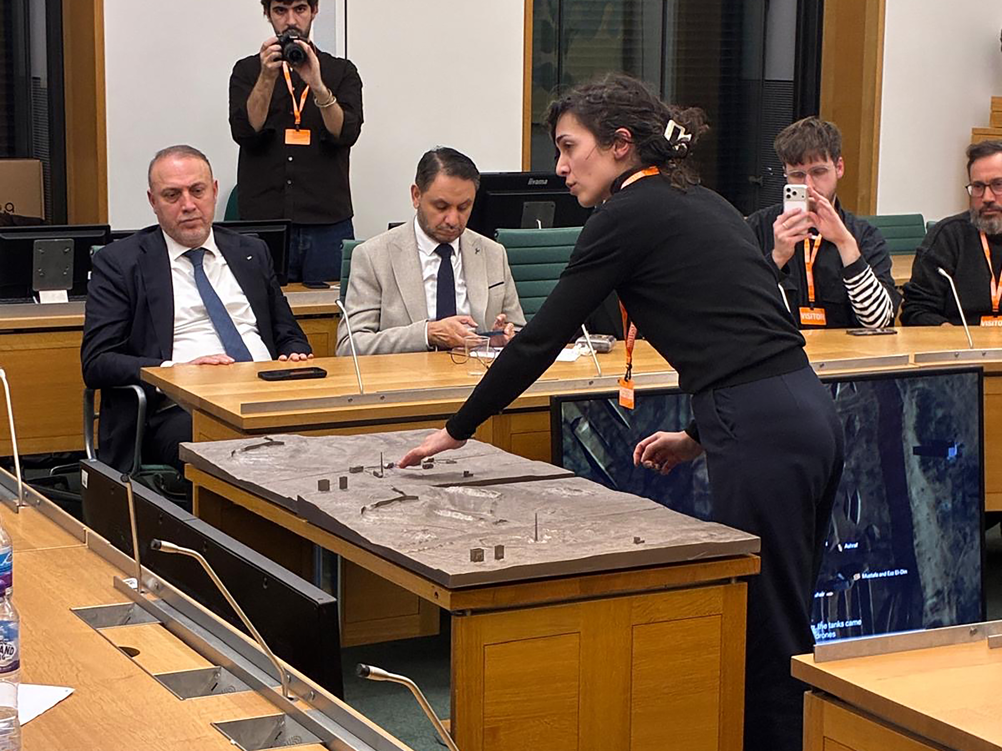
From the outset, the investigative teams staged their audiovisual reconstruction and reports, along with two physical models,3 as a multimedia apparatus for presenting their findings across multiple scales. When the room’s audiovisual systems faltered—the audio cut out, the video presentation glitched, and the sequence of the digital reconstruction stalled—the models sustained a mode of address already established by the presentation. Samaneh Moafi (Assistant Director of Research, Forensic Architecture) moved around the models, guiding the room through her gestures, orientation, and spatial reference—pointing to where the ambulances arrived, tracing routes across the surface of the models, and marking the separate locations where IOF forces later buried the aid workers and emergency vehicles.
While architectural practice often makes use of physical models to project spatial propositions, coordinate design decisions, and communicate anticipated built conditions, their evidentiary value remains underexplored. The aforementioned investigation stands apart for having commissioned models for the presentation, thus choosing to bring material reconstruction into direct relation with satellite imagery, sound, testimony, and geolocation data. On that day at Parliament, only six months after the United Kingdom had formally recognized the State of Palestine,4 the models entered a political register shaped by their evidentiary construction within the supreme legislative body of the United Kingdom.5
The construction of the models sought to establish a material and spatial point of reference within the parliamentary setting, enabling a mode of legibility irreducible to visual or auditory evidence alone. The models thus acted as a public interface capable of mediating between the evidentiary assemblage constructed by the investigation and its political interpretation. Screens displaying the investigation’s audiovisual material were placed low in front of the tables, requiring viewers to peer over the surfaces to follow the reconstruction. Positioned near the center of the chamber, the models nevertheless remained physically distant from many of those gathered around them. This arrangement produced a peculiar tension between visibility and access; although the models occupied a central position, both they and the low-placed screens remained unevenly accessible throughout the room.
As Moafi spoke, the participants paid closer attention, leaning in, pointing to specific locations, and repositioning themselves in order to follow the chronology of the attack from different angles. Despite moments of technical interruption mandated by the format of the larger presentation, the models operated throughout Moafi’s sensorial engagement, drawing the bodies of those present, the evidence, and their interpretation into a shared field.6
The interruptions bring to light a broader relation between the media produced for the investigation. Contemporary forensic presentations organize evidence through sequences: camera frames direct attention, timelines structure interpretation, screens establish orientation, and reports develop legibility through linear narration. Models, however, add material continuity, holding spatial relations in view as the presentation moves across each medium.
In tracing the evidentiary value contributed by architectural models prepared for two cases investigating human rights abuses, in Gaza and Gaziantep, I argue here that architectural models can sustain a shared spatial field long enough for different forms of evidence, gestures, and interpretations to intersect, curating the circumstances wherein participants might return, compare, and keep the discussion in circulation.
The Many Incarnations of Architectural Models
Architectural models are a meticulously scaled-down proxy of unbuilt ambition—an object through which architects simulate control over space, time, and capital using wood, resin, and the occasional whisper of idealism. Typically constructed to impress clients, secure permits, or seduce juries, the architectural model is utilized as a tool for reflection and a performative gesture—part diagram, part bait. It offers the illusion of democratic spatial foresight while functioning primarily as a placeholder for financial speculation, a three-dimensional promissory note for future displacement. Displayed under halogen lights or locked behind acrylic vitrines, it is both artifact and advertisement: a physical narrative rendered at 1:100 scale, where trees are always in leaf, shadows are fixed in a perpetual golden hour, and not a single person appears unhoused. For the discipline of architecture, it serves as a fetish object—a tiny world of imagined order into which uncertainty is not invited. For design culture, it is evidence of labor, precision, and the performance of intellect. And for real estate, it is an asset preview—a seductive glimpse of profitable square footage awaiting monetization. The model pretends to be inert, but it moves silently through planning departments, funding boards, marketing campaigns, and eventually, the speculative domain—always pointing to a future that is both inevitable and for sale.
At the same time, the architectural model is increasingly redirected from the machinery of development toward the reconstruction of state violence, environmental destruction, displacement, and atrocity.
Investigative practice transforms the model into a site where investigators, witnesses, judges, and audiences test spatial relations, testimonies, and competing claims in material form. And as models enter courtrooms, parliamentary hearings, tribunals, and human rights investigations, these acts of handling reorganize relations between evidence, testimony, expertise, and spectatorship.
The models produced for the Gaza and Gaziantep investigations belong to a longer history of using miniature environments to direct and organize attention through spatial relations. Frances Glessner Lee’s “Nutshell Studies of Unexplained Death” provide an early forensic precedent, training investigators to build judgment through spatial observation, comparison, and repeated inspection.7 This pedagogical lineage situates the models within a tradition of sustained spatial attention; contemporary investigative practice extends this capacity into contested forums, where human rights claims become matters of public and legal negotiation.
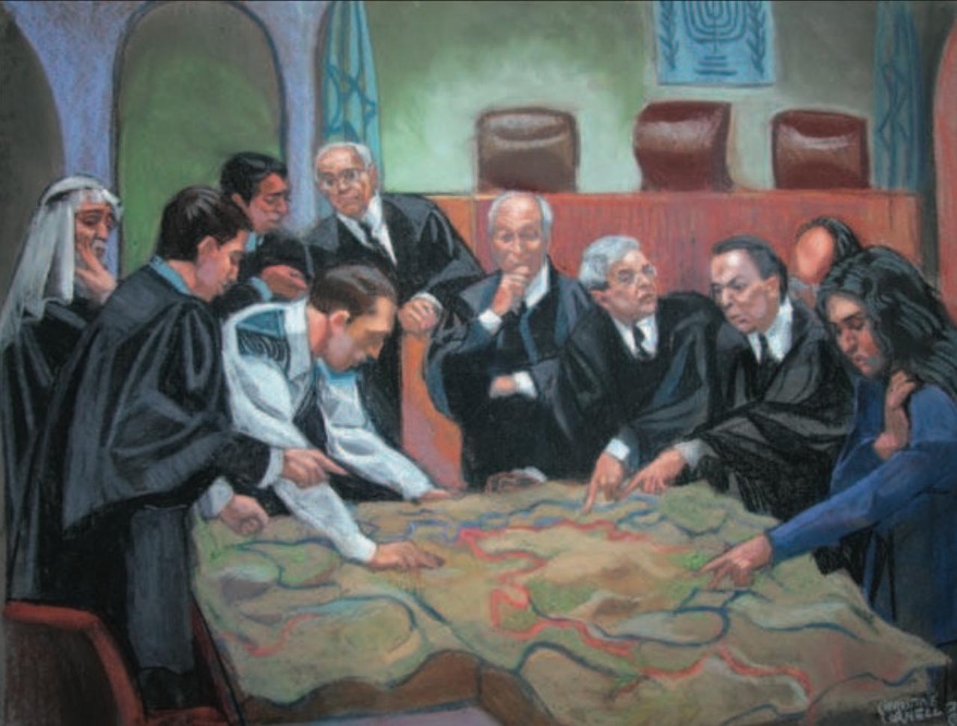
The annihilatory violence unfolding across Gaza today extends a colonial project through which Israel has, for decades, reorganized Palestinian land, mobility, infrastructure, and life.8 From the routing of the separation wall across the West Bank to the bulldozed mass graves and militarized earthworks of Tel al-Sultan, violence repeatedly inscribes itself onto the terrain, transforming the ground into both target and instrument of domination. This continuity places the Tel al-Sultan models in relation to Beit Sourik Village Council v. Government of Israel in 2004.
This case concerned a petition against the planned route of Israel’s separation wall in the northern West Bank, where Palestinian villages faced the confiscation of and dislocation from their agricultural land, road access, and everyday movement under the wall’s proposed positioning. The petitioners included the Beit Sourik village council together with residents and representatives from Beit Sourik and neighboring villages including Bidu, El Kabiba, Katane, Beit A’anan, Beit Likia, Beit Ajaza, and Beit Daku—all standing against the government of Israel and the commander of the IOF Forces in the West Bank.9
Finding the existing drawings and cartographic representations of the terrain difficult to comprehend, the judges instructed the petitioners to produce and present a physical relief model of the landscape to the hearing. Once installed within the space of the hearing, it was immediately obvious to those present that the fixed hierarchy through which legal proceedings ordinarily unfold could no longer hold. President Aharon Barak, Vice-President Eliahu Mazza, and Justice Mishael Cheshin would eventually descend from the raised judicial bench to inspect the model as the Palestinian petitioners and state representatives assembled around it.
As the hearings progressed, those gathered around the model traced the proposed route of the separation wall across the hills and valleys northwest of Jerusalem. Red lines marked the route that the Israeli military and state authorities preferred, while green lines marked alternatives that the petitioners and supporting security experts proposed. Participants pointed to ridgelines, valleys, roads, and cultivated land as they tested how each route would reorganize Palestinian mobility and reshape their access to agricultural land, water, and road networks.
The judges, petitioners, and state representatives leaned over the model, shifted their orientation, pointed across elevations and ruptures in the landscape, and followed competing territorial claims through body movement. Legal and political arguments followed the contours of the land as the model redistributed attention across the room and made the territorial consequences of the proposed wall collectively addressable. Here, the model operated as an evidentiary surface through which the court heard and tested competing political futures. In this sense, the model functioned as a preemptive instrument, contesting a spatial outcome before its realization. As Weizman writes, forensic architecture “focus[es] [its] attention on the materiality of the built environment and its media representations” to “make claims publicly and politically in the most antagonistic of forums.”10
While the Beit Sourik ruling compelled the Israeli state to alter sections of the then-proposed separation wall, subsequent events reveal the severe limitations of juridical intervention against an expanding apparatus of settler colonial violence. Since October 7, 2023, the Israeli military has systematically devastated Gaza through aerial bombardment, artillery strikes, siege tactics, forced displacement, and the widespread destruction of civilian infrastructure. As of September 2026, Israeli forces have killed more than 73,000 Palestinians in Gaza, injured well over 175,000, and forcibly displaced the overwhelming majority of the population, while large areas of the territory remain uninhabitable due to bombardment, excavation, and military earthworks.11 IOF operations continue to level buildings, excavate roads, construct fortified berms, and reorganize the terrain as part of ongoing campaigns of territorial control and erasure.
Across Palestine, military action and imaging regimes persistently transform the conditions through which violence becomes legible. Commercial satellite providers have restricted the frequency and resolution of imagery available over Palestine through mechanisms such as the Kyl-Bingaman Amendment and subsequent licensing limitations,12 while Israeli military operations continually transform the ground through engineered buffer zones such as the expanding “yellow line” corridors that sever movement and visibility across Gaza.13
As Gaza’s material conditions undergo relentless reconfiguration and destruction, how to keep the violence perceptible becomes a central evidentiary task: military operations flatten sites, sever access, obstruct observation, and transform the ground before documentation stabilizes into evidence. Forensic accuracy therefore depends on sustained attention. The model demands a slow pace, asking observers to linger, compare, return, and confront spatial consequences collectively. This temporal and bodily association turns reconstruction into a political act of maintaining material legibility and opens forms of engagement through a politically contestable field oriented toward anti-colonial struggles and global justice.
Sculpting Tel al-Sultan
The Massacre of Aid Workers in Tel al-Sultan brings satellite imagery, audio recordings, witness testimonies, and geolocation data into relation across a field in which IOF atrocities shape the evidentiary record. By correlating these fragments, the investigation argues that Israeli military operations weaponize the built environment and terrain as integral to the ongoing assault on the people of Palestine, further elucidating the scope of this never-ending atrocity and the escalation of settler colonial destruction.14 Through their arrangement, this documentation and analysis acquires political and evidentiary force, and together they formulate an argument testifying to the Israeli military’s genocidal actions—its annihilatory rule—compounding the military occupation, apartheid, infrastructural control, and persistent surveillance that dictate Palestinian life and death.15
The investigation built this relational field through precise operations: investigators extracted metadata from media files to establish chronologies, compared shadow lengths in satellite imagery to estimate the height of objects, and triangulated gunfire by analyzing differences in sound intensity across recordings made at different locations. They cross-referenced these findings with the account of a single surviving witness, identifying points where the witness’s descriptions of movement corresponded to detectable traces—tire marks, disturbed soil, or the repositioning of vehicles between images taken hours apart.
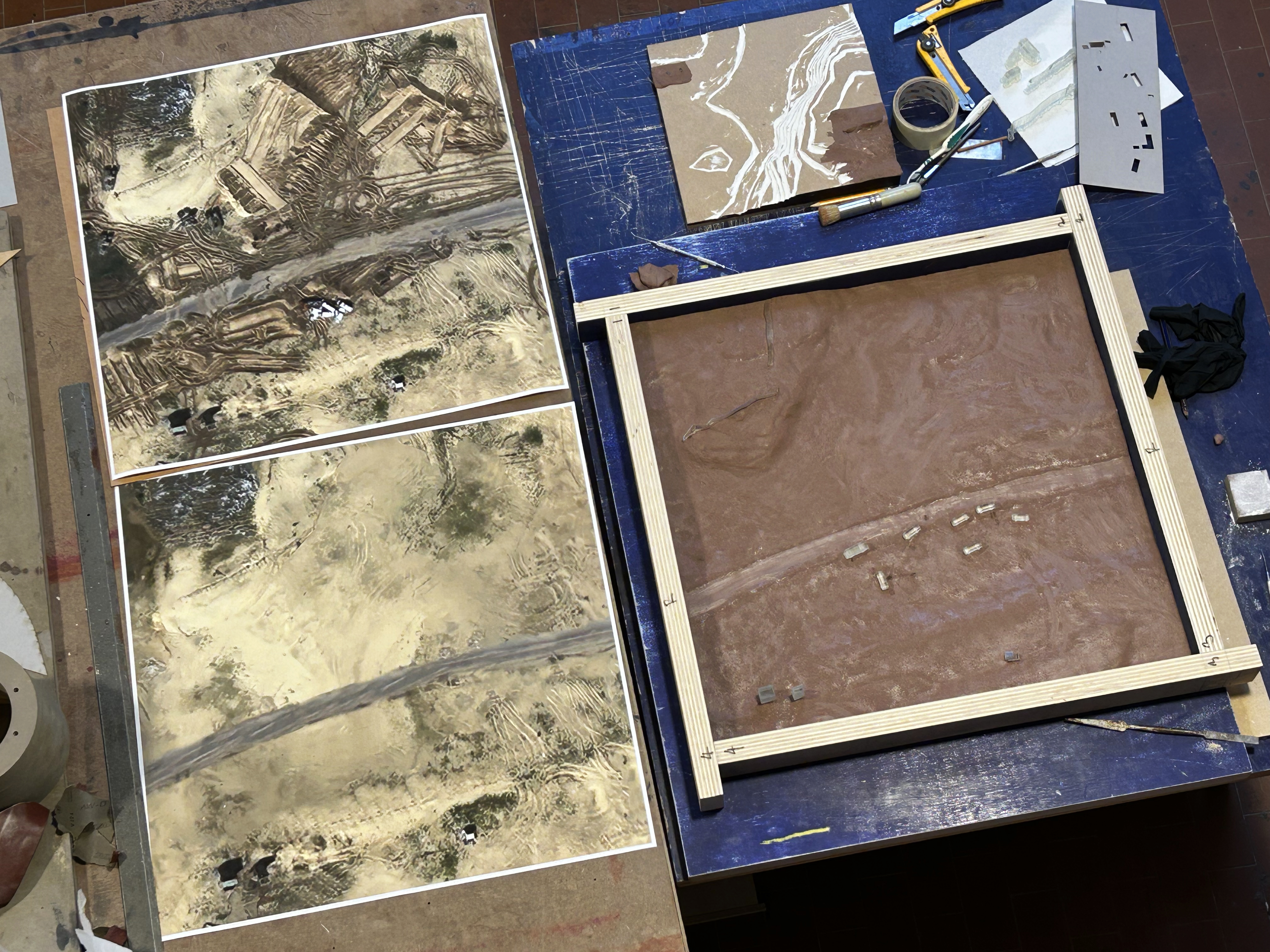
The restricted and limited resolution of available imagery over Palestine creates a set of obstacles—edges blur, surfaces flatten, and key areas remain indeterminate. The modeling process reads these conditions through a wider politics of visibility and tests fidelity through material differentiation: vegetation, exposed soil, rubble, asphalt, and manually constructed berms become surfaces through which military violence inscribes itself. The investigation translates these visual uncertainties into a material comparison between the two models, each representing the same site at different moments separated by five hours and forty minutes. The first model reconstructs the terrain at 5:08 a.m. along a sandy road, where Israeli military fire struck a convoy of Palestinian Red Crescent Society ambulances, a fire truck, and a United Nations vehicle in the early hours of March 23, 2025. A mobile phone recording captures the sounds of sustained gunfire lasting several minutes; investigators correlated this recording to satellite imagery and geolocation data to determine the position of Palestinian bodies, vehicles, and advancing IOF units across the site.
The second model depicts the same site at 10:48 a.m., reconstructing its radical transformation through Israeli military earthworks. Satellite imagery shows that military bulldozers had reworked the terrain, constructing large berms across and alongside the road, rerouting movement through the area and partially obscuring the site from view. Within this altered landscape, the ambulances and emergency vehicles were buried beneath displaced soil and debris in one area of the site, while the bodies of the aid workers were buried separately in a nearby shallow mass grave. The investigation identifies freshly disturbed earth surrounding both burial zones, while the contours and extent of the berms are traced through changes in the terrain visible across successive satellite captures.16
Side by side in the parliamentary chamber, the models hold these two states of the site at identical scale. Participants shift between them, compare distances across both surfaces, point to one location while keeping another within view, and return to earlier relations while the wider field remains present. Computer animation and written reports sequence evidence through successive frames and pages; the physical models sustain several spatial relations for collective inspection at once. Their horizontal surfaces let several people orient themselves around the same evidentiary field, making gesture, scale, and co-presence part of the interpretive act. Through this arrangement, the models produce a mode of collective comprehension17 grounded in simultaneous comparison and shared orientation—enabling each participant to stage, test, and contest claims around a shared spatial reference and direct those claims toward justice.
The making process develops this capacity through repeated material tests. With each pass, the reconstruction aligns shadows, marks, and breaks in the terrain across different sources until spatial relationships begin to hold. Gaps in the evidence direct successive revisions: a structure that appears in one image and disappears in another, or a mark with an uncertain source, prompts another adjustment and comparison across the evidentiary field. Each cut, compression, and displacement tests a relation and leaves that decision materially legible. The model accumulates these revisions as a record of investigative decisions that subsequent evidence can confirm, amend, or displace.

These modelling operations mirror actions that IOF forces carry out on the ground with heavy machinery as they move earth, bury bodies and vehicles, and remove visible traces of the event. The model maker’s gestures emulate cutting marks where heavy machinery tore open the ground; displacing material registers with redistributed soil; leveling sections record how IOF forces razed structures and vehicles while attempting to erase their traces. This inversion of movement and intention indexes violence through differences in height, texture, and continuity. The model brings the material logic of those operations into view and positions the terrain itself as an evidentiary surface.
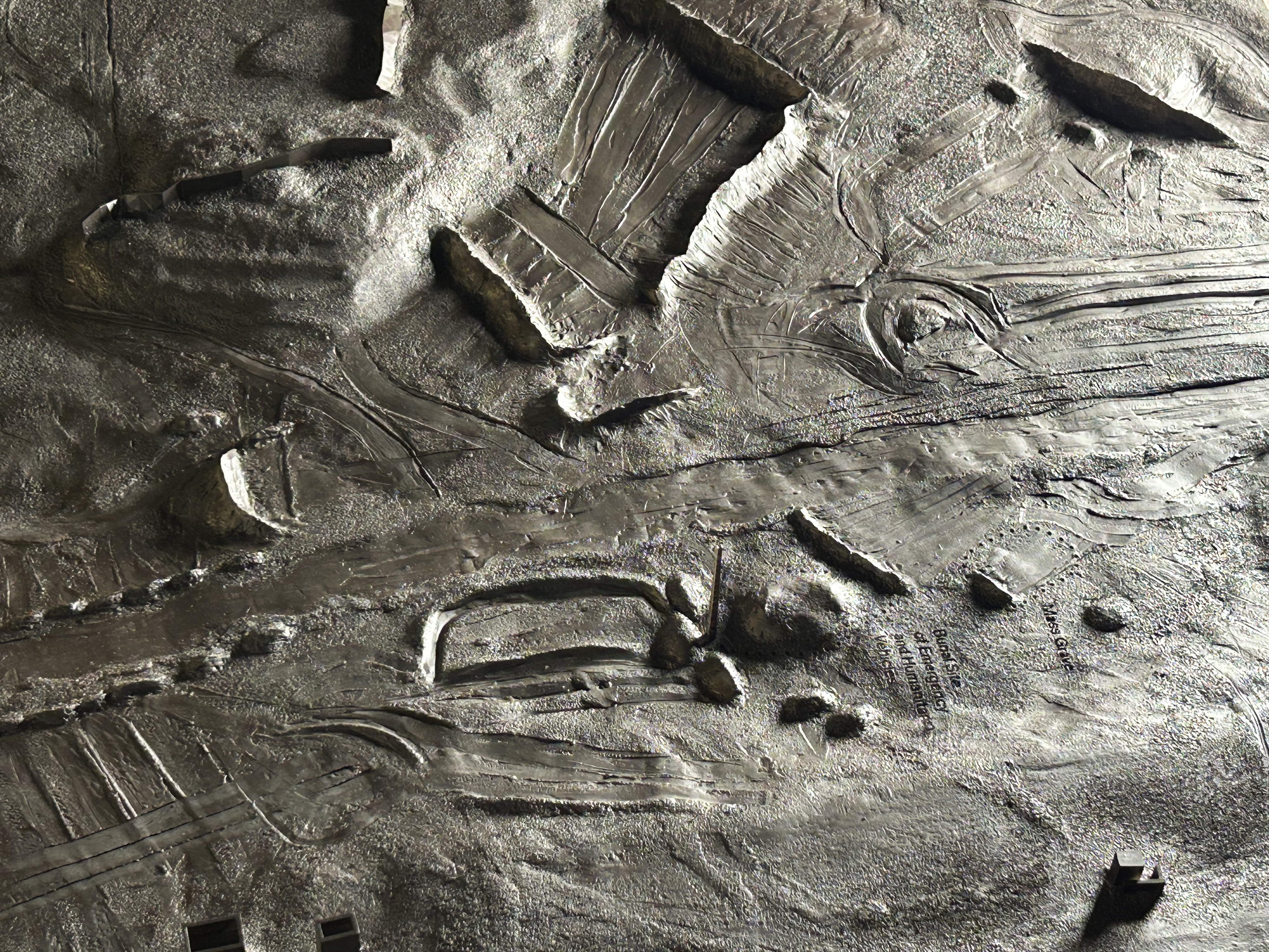
These operations establish a replicable method: locating disparate evidentiary fragments, anchoring them in their materiality, testing their spatial relations, and revising the reconstruction as new evidence emerges. The model gives this process a material form, lending the investigation and its findings an undeniable presence within the parliamentary domain. The method remains grounded in the specific material and territorial conditions of Rafah’s Tel al-Sultan neighborhood and the actions of the IOF, where sandy access roads, heaved earth, bulldozed berms, damaged vegetation, and the edges of urban infrastructure become critical surfaces through which investigators reconstruct the killings.
This approach becomes especially important within the ceaseless decimation of Gaza, where human rights investigations are confronted with a terrain in continuous transformation and where violence accumulates against the land and people across generations. Gaza is altered ground: obliterated surfaces, missing structures, disturbed earth, and fractured urban fabric. Model making gathers those fragments into sustained relation across this palimpsestic brutality—reconstructing violence through the accumulation of spatial transformations, erasures, and material traces.
These models do not operate outside power structures. Their construction depends on access to satellite imagery, open- and closed-source data, forensic tools, and institutional support. These dependencies shape what investigators can reconstruct, what remains in/accessible, and which events enter the field of visibility at all.
Situating these models within the halls of the British Parliament connects demands for recognition, accountability, and intervention to institutions historically entangled with the production, administration, and geopolitical protection of colonial violence in Palestine. The models materialize this contradiction by placing evidence before those whose decisions determine whether what becomes legible leads to action. They also expose a further limitation: precise, navigable, and publicly legible evidence must pass through political structures capable of withholding intervention.18 What the models secure is persistence: they hold the event in view, fix it within a shared space of reference, and resist its erasure while its consequences remain politically unresolved.
Between Representation and Lived Experience
Situated within the longue durée of anti-imperial, migrant justice, and human rights investigations emerging from the so-called 2015–2016 European refugee crisis, the following investigation extends a broader forensic engagement with the spatial and material conditions through which institutions organize borders, labor regimes, and state violence. In collaboration with Border Forensics,19 this investigation similarly engages in a concerted model-making practice, this time to bolster the documentation of migrant labor exploitation within the textile and petrochemical industries of Gaziantep, Turkey. Departing from the EU-Turkey Statement of March 2016,20 it traces how the European Union externalizes its border management, shifting responsibility to peripheral countries such as Turkey, selectively restricting mobility while entrapping displaced populations as a disposable labor force.
Categories such as “temporary,” “undocumented,” and “illegal” do not simply describe migrants; they actively structure the conditions under which people live and work. In Gaziantep’s textile and petrochemical sectors, Syrian workers are employed under precarious citizenship status. This is not a breakdown of regulation but an elemental cog in an insatiable system.21 Ambiguity is the tool: allowing participation in labor markets without granting full rights sustains an informal, low-cost workforce while limiting the ability of these oppressed communities to organize. Border regimes and industrial production thus operate in tandem, producing this labor force and the policies that regulate them, shaped by restriction, dependency, and disposability—a workforce primed for exploitation.22
To document these human rights violations, Border Forensics mobilizes a counter-forensic methodology that integrates legal inquiry, visual documentation, and testimonial accounts. Within this framework, interviews become sites of spatial and epistemic negotiation. Across twenty-five participants—six of whom returned for multiple sessions—architectural models mediate the encounter. Presented as operative diagrams, the reconstructions—which include a transnational carpet manufacturing facility, a carpet substrate production line located within a petrochemical plant, and a small-scale Syrian-owned clothing atelier—do not contain identifying features.
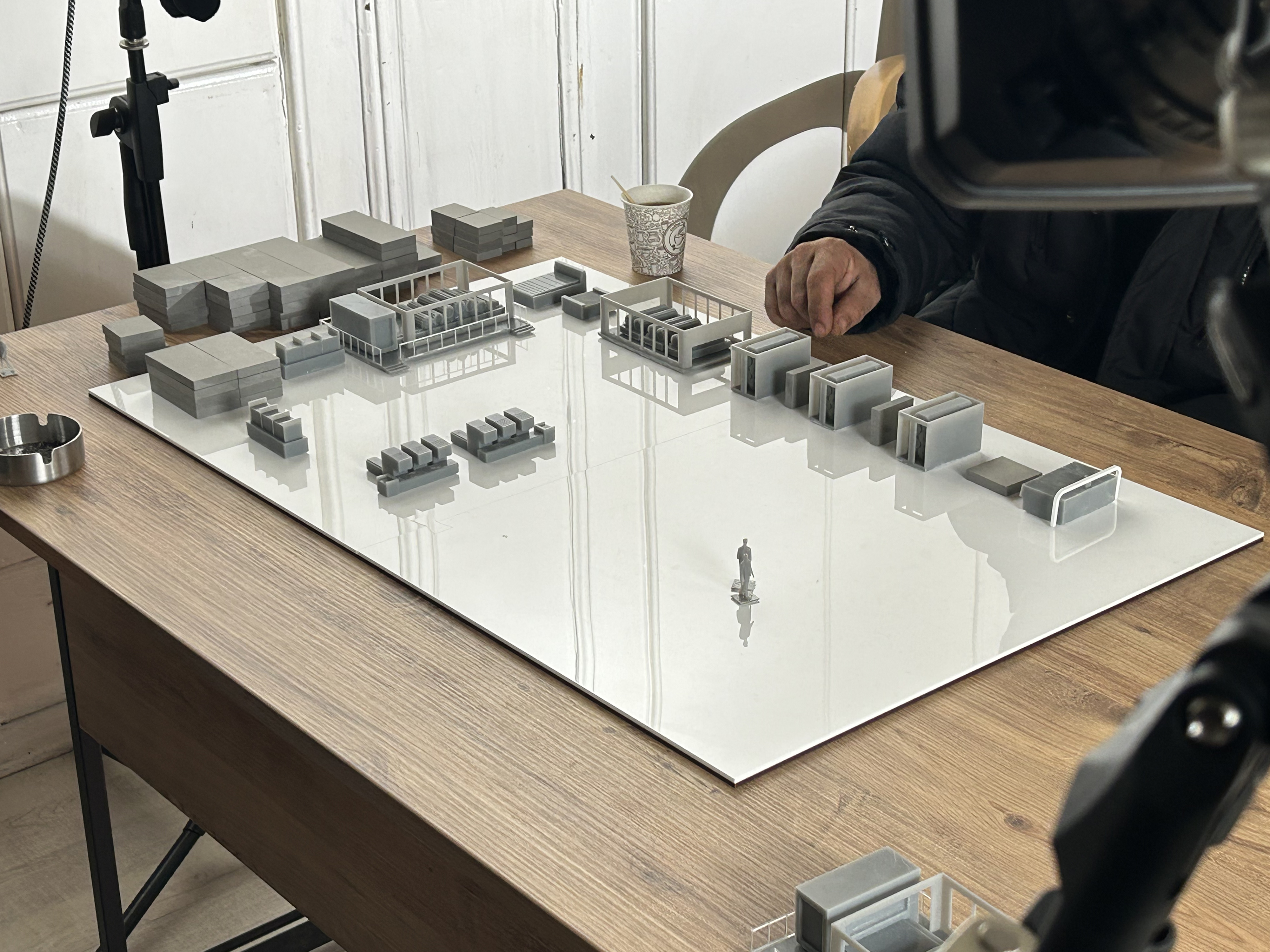
Each participant can use the models to assemble workplace knowledge across multiple accounts. One worker traces a production route; another identifies a bottleneck, restricted zone, or supervisory point; subsequent interviews confirm, amend, or complicate those spatial relations. As these annotations accumulate, the models become shared indexes of industrial organization, linking individual experience to collective patterns of labor exploitation. The surface of these models therefore records both singular testimony and the points at which separate accounts converge.
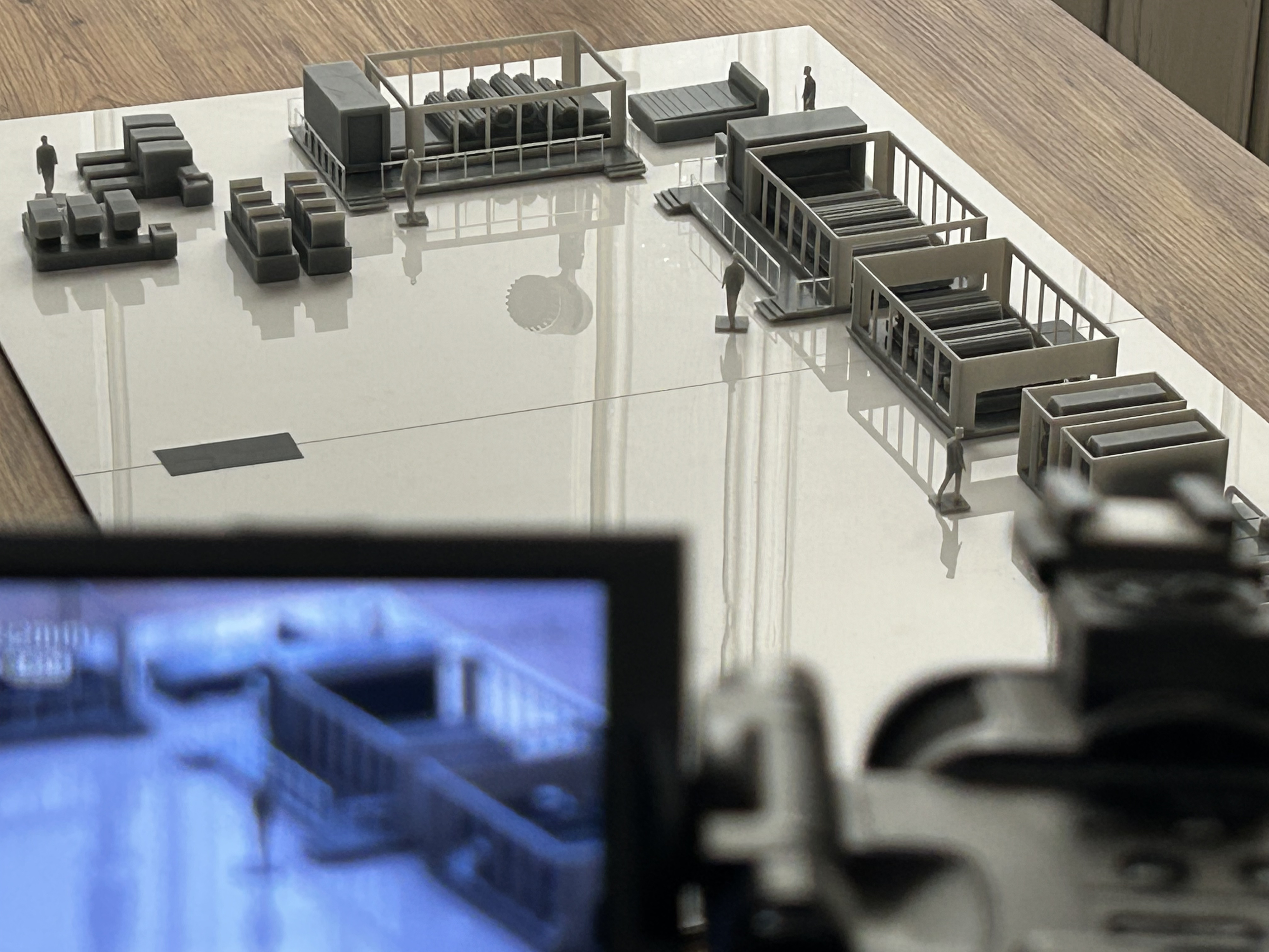
The interviewee’s hand becomes a crucial instrument within this process. Tracing, tapping, and hovering translate timing, proximity, pressure, and machine relations into a testimony. Lighting extends this record: as participants lean over the model, shadows and reflections register a corporeal presence across its surface while the framing preserves anonymity. At moments, the shadow of a hand aligns with the space described by a participant—merging the body with the site. The model receives these movements as evidence of sequence and relation, allowing participants to indicate what transpired with spatial precision while controlling the terms of their visibility. This capacity matters in a context where laborers face repercussions for speaking about workplace exploitation and where visibility itself carries risk.
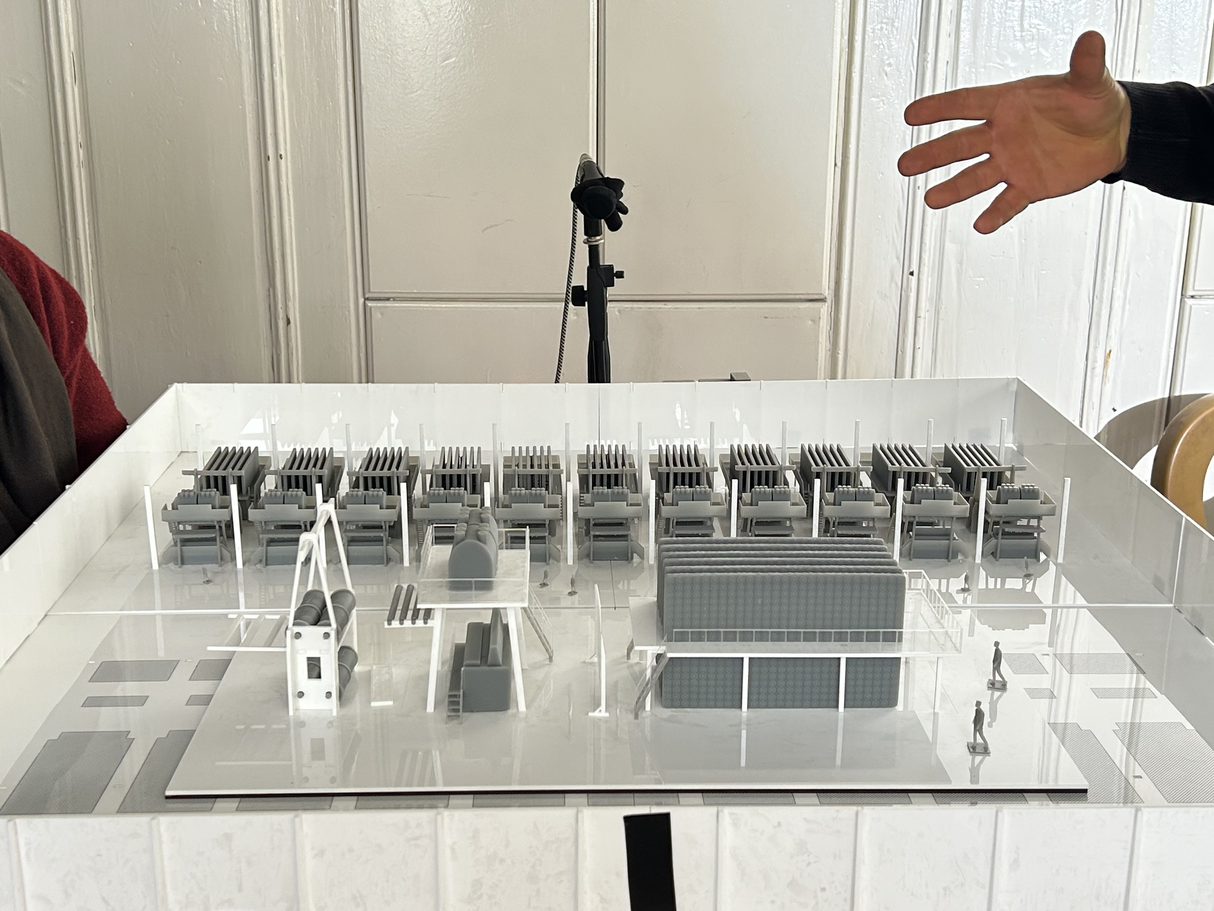
The same properties that make these models effective also introduce methodological and ethical tensions. Rather than distancing participants from their experience—as representation is often assumed to do—the models can bring them closer to it. By reproducing the spatial and mechanical conditions of the workplace, they carry the risk of collapsing the distance between representation and lived experience, drawing participants back into moments of injury, exhaustion, or coercion.23 In these instances, as they trace events, return to specific locations, or slow down during reconstruction, the model becomes a site of reenactment, placing them back within the structure of the event. The distinction between recalling and reliving begins to blur as the layout of the space reactivates not only memory but the physical and emotional intensity associated with it. What emerges is a form of representation that does not reduce experience to abstraction but instead registers its proximity—bringing the participant into contact with the conditions they describe, and exposing the difficulty of separating analysis from experience.
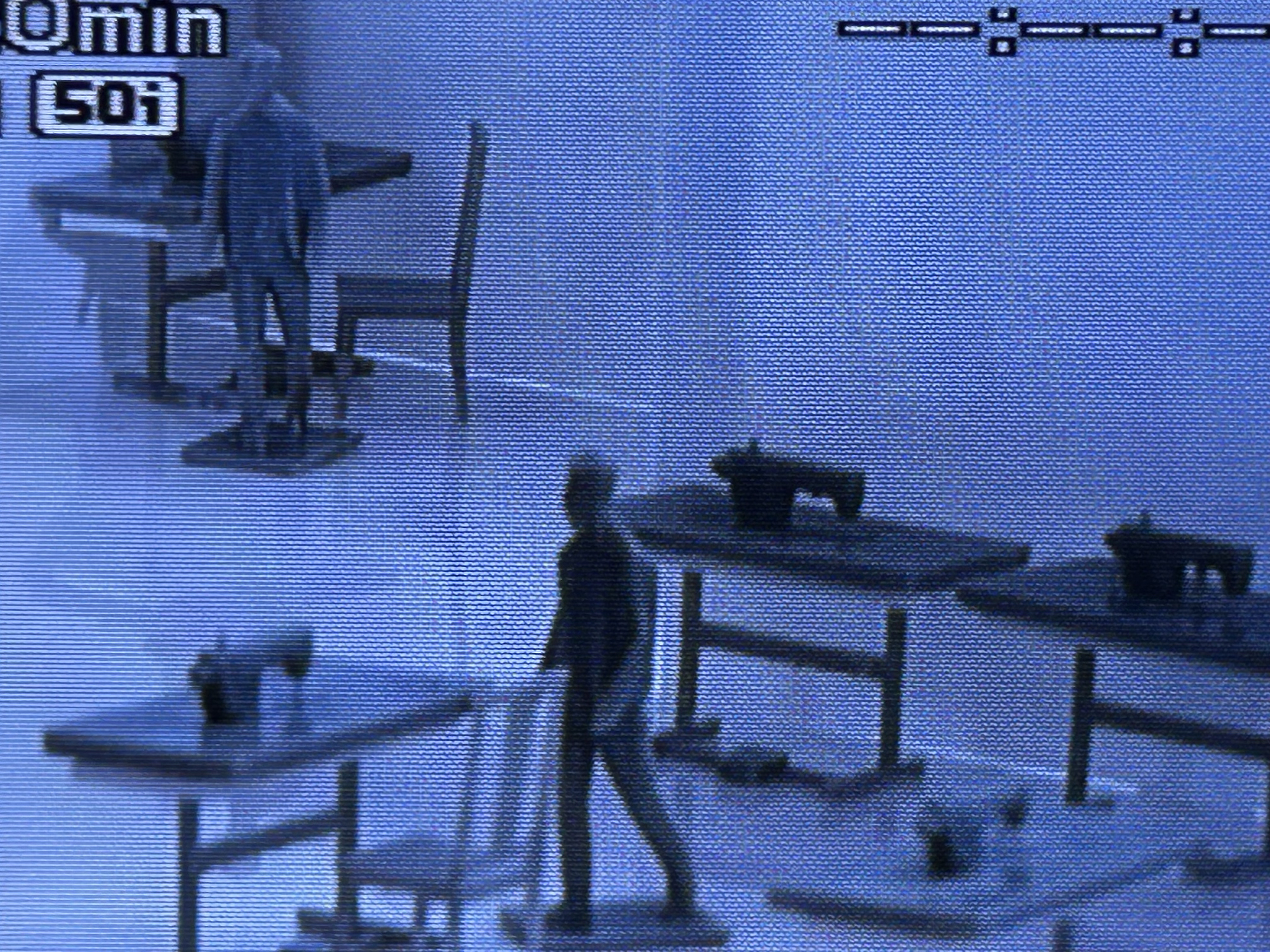
This risk does not manifest equally with every interviewee. It depends on how closely the model resembles a participant’s experience and on the events they describe. Some move steadily across the surface, while others hesitate or stop, pause for breath, fall silent, retrace movements, or struggle to continue speaking. This variation exposes both the limits and the stakes of the method. The same features that allow precise description can also intensify engagement with painful memories. Tensions aren’t necessarily resolved in this process. As investigators adjust the pace of the session, pause when needed, and allow participants to step back or redirect the discussion, they produce detailed accounts that depend on these conditions. Thus, the architectural model exposes the psychological costs of reenacting one’s experiences.
As models are increasingly used in investigative practices that concern exploitation, occupation, displacement, and militarized control, they also enter an age defined by escalating and uneven proximities to violence. No longer confined to representing isolated buildings or bounded events, they now mediate conditions in which violence operates across territories, infrastructures, ecologies, labor systems, and borders—distributed spatially, technologically, and politically across everyday life.
Against the Horror
In the investigations presented here, the architectural model moves beyond its conventional role when deployed in forums that determine what counts as truth. The model maker, considered as both architect and investigator, navigates this terrain as an active reader, negotiating between abstraction and materiality while engaging the limits of resolution, access to data, and computational legibility.
Within this configuration, the physical model introduces a distinct order of inquiry that repositions knowledge production within a field of embodied engagement. Here, the hand assumes a central role as the means through which data is translated into physical form, with decisions and uncertainties becoming sedimented on the surface of the model.
This shift extends beyond method to the conditions of understanding itself. Scale, material resistance, and corporeal engagement introduce friction, challenging the assumption that clarity derives solely from computational precision or visual resolution. Instead, understanding takes shape through an encounter that positions both model maker and audience within a shared field where evidence is produced and contested. In this sense, the model is both mediator and translator, collaborating with technoscientific methods while reconfiguring how the resulting knowledge is circulated.
Within the production of public truth, this distinction is critical. Forensic practices are oriented toward diverse forums—courts, parliaments, media platforms—where evidence must be not only accurate but persuasive, intelligible, and sharable. The model contributes by translating digital analysis into forms that can be collectively apprehended. The efficacy of this undertaking means encounter. It reorganizes attention and proximity, and unsettles—however briefly—the hierarchies through which expertise operates. In doing so, the model facilitates conditions where technical, experiential, and testimonial knowledge converge.24
The materiality of the model resists full assimilation. Digital images circulate evidentiary material across various contexts and scales; the physical model contributes another material register by occupying space, bearing marks, and recording the labor of its making—the pressure of hands, the adjustments, and the decisions embedded in its surface. These traces matter. They index a process of inquiry that is situated and contingent, foregrounding the model maker as both producer and participant in the evidentiary process.25 In this sense, the model does not only support the production of public truth; it makes visible how that truth is constructed. Investigators select and align satellite images, reposition video fragments, test ideas, and revise assumptions through repeated adjustments. The model, and its making, reveal these operations—what is included, what remains uncertain, and how different forms of evidence are brought into relation.
Evidence does not appear as a given; it is produced, measured, and compared through interactions between investigators, participants, and the model itself.26 The model maker becomes part of this process, shaping how events are reconstructed while responding to its constraints.
What emerges through these considerations is not simply another method of representation but a struggle over persistence itself. As contemporary violence is increasingly organized through distance, infrastructural abstraction, automated targeting, border externalization, environmental devastation, and the rapid erasure of evidence, the capacity to collectively apprehend these conditions becomes a political question of growing urgency. Model making enters this terrain as a spatial practice that resists disappearance. In this sense, the architectural model no longer belongs solely to the design studio, museum, or planning office. It moves into courtrooms, parliaments, workplaces, refugee infrastructures, occupied territories, and devastated landscapes—sites where the truth remains unstable and where visibility itself is unevenly distributed. Its significance lies not only in what it shows but in what it enables: forms of collective attention, embodied engagement, and political confrontation that exceed passive observation. Against the escalating disappearance of evidence, the horrors and atrocities perpetrated across Palestine and beyond, these practices insist that reconstruction can still operate as a mode of resistance—one capable of sustaining memory, demanding attention, holding presence, contesting power, and opening new grounds from which demands for justice might emerge.
-
For details on the investigation and its findings, see: Forensic Architecture and Earshot, “The Massacre of Aid Workers in Tel al-Sultan,” Forensic Architecture, 2026, link. ↩
-
Earshot is a nonprofit organization based in London, founded in 2023 by Lawrence Abu Hamdan. Building on over a decade of research and advocacy, its investigations treat sound—from gunfire to drone noise—both as a trace of violence and as a medium through which control is exercised, restoring the sonic environment as a site of forensic and political analysis. See link. ↩
-
In preparation for the presentation, Forensic Architecture commissioned the production of these models to Modelab—a production and experimentation studio based in Rome, Italy, formed by the architect Marco Galofaro in 2002, that also includes Marcello Moroni, Antonia Mariconda, and Kamil Dalkir. ↩
-
The United Kingdom’s formal recognition of the State of Palestine marked a significant diplomatic shift within the broader geopolitical landscape surrounding the ongoing assault on Gaza and the question of Palestinian sovereignty. See UK Government, “UK Formally Recognises Palestinian State,” GOV.UK, September 21, 2025, link. ↩
-
The event was hosted by the British Palestinian Committee (BPC), sponsored by Simon Opher MP, and chaired by Dr. Zena Agha, Director of the BPC, with contributions by Samaneh Moafi, Lawrence Abu Hamdan (Director, Earshot), and Dana Abu Koash (Coordinator of the International Humanitarian Law Unit, Palestine Red Crescent Society). Also seated in the room were Eyal Weizman (Director of Research, Forensic Architecture), Jeremy Corbyn MP, and the extended teams of Forensic Architecture and Earshot. ↩
-
Yael Padan’s discussion of models as spatial narrative devices provides an understanding of how physical reconstructions organize collective interpretation through shared acts of viewing, orientation, and engagement. See Yael Padan, “Modelscapes: The Model as a Spatial Narrative Device,” in Models: Performance, Worldmaking and Design (London: Routledge, 2017), 13. ↩
-
Frances Glessner Lee constructed the “Nutshell Studies of Unexplained Death” in the 1940s and early 1950s as 1:12–scale scenes for Harvard Medical School’s Department of Legal Medicine. Harvard Medical School established the Seminar in Legal Medicine in 1944, in which investigators used the models to practice systematic observation, preserve spatial relations, and reason across distributed details. The series established miniature model–making as a pedagogical instrument for homicide investigation in the United States. For further reading, see Corinne May Botz, The Nutshell Studies of Unexplained Death (New York: Monacelli Press, 2004); and Bruce Goldfarb, 18 Tiny Deaths: The Untold Story of Frances Glessner Lee and the Invention of Modern Forensics (New York: Sourcebooks, 2020). ↩
-
Eyal Weizman’s investigations of the spatial and architectural dimensions of Israeli occupation provide a critical framework for understanding the ongoing destruction of Gaza as an intensification of long-standing colonial practices through which Palestinian territory, infrastructure, mobility, and conditions of life have been systematically reorganized, controlled, and destroyed. For further reading, see Eyal Weizman, Hollow Land: Israel’s Architecture of Occupation (London: Verso, 2007); and Eyal Weizman, Ungrounding: The Architecture of Genocide (London: Fern Press, 2026). ↩
-
Aharon Barak, Eliahu Mazza, and Mishael Cheshin of the Supreme Court of Israel presided over the proceedings. Representing the Israeli state were military officials, legal representatives, state authorities, and members of the Council for Peace and Security—including Major General (res.) Danny Rothchild, Major General (res.) Avraham Adan (Bren), Commissioner (emeritus) Shaul Giv’oli, and Colonel (res.) Yuval Dvir. ↩
-
Eyal Weizman, Forensic Architecture: Violence at the Threshold of Detectability (New York: Zone Books, 2017), 11. ↩
-
For additional documentation on the humanitarian conditions produced through the ongoing assault on Gaza and the occupied West Bank, see United Nations Relief and Works Agency for Palestine Refugees in the Near East (UNRWA), UNRWA Situation Report #236: On the Humanitarian Crisis in the Gaza Strip and the Occupied West Bank, Including East Jerusalem (October 7, 2026), link. ↩
-
The Kyl-Bingaman Amendment, enacted in 1997 as part of the U.S. National Defense Authorization Act, prohibited the commercial distribution of high-resolution satellite imagery of Israel and the occupied Palestinian territories beyond the level commercially available from non-U.S. sources. The amendment significantly restricted the visual documentation of Israeli military activity and territorial transformation from space, shaping the geopolitics of visibility, surveillance, and evidentiary production in Palestine for more than two decades. See National Defense Authorization Act for Fiscal Year 1997, Pub. L. No. 104–201, § 1064, 110 Stat. 2422 (1996); and Nadia Abu El-Haj, Facts on the Ground: Archaeological Practice and Territorial Self-Fashioning in Israeli Society (Chicago: University of Chicago Press, 2001). ↩
-
For further reading on restrictions on satellite imagery over Palestine and Israel, see Jessica McKenzie, “Why High-Resolution Satellite Images of Gaza Are Hard to Come By,” Bulletin of the Atomic Scientists, October 27, 2023, link; on the territorial reconfiguration of Gaza through military corridors, buffer zones, and militarized earthworks, see Forensic Architecture and Earshot, Israeli Executions of Palestinian Aid Workers (London: Forensic Architecture, 2026), link. ↩
-
Bruno Latour’s distinction between “matters of fact” and “matters of concern” provides an important perspective on how political meaning emerges through the assembly and relation of heterogeneous fragments rather than from isolated evidence alone. A related logic appears in Robert Bresson’s conception of cinematic composition, where meaning is produced through the juxtaposition, sequencing, and relational arrangement of discrete images within a larger structure. See Bruno Latour, “Why Has Critique Run Out of Steam? From Matters of Fact to Matters of Concern,” Critical Inquiry 30, no. 2 (2004): 225–248; and Robert Bresson, Notes on Cinematography, trans. Jonathan Griffin (New York: Urizen Books, 1975), 8. ↩
-
Achille Mbembe describes this logic as “necropolitics”: forms of sovereign power that organize domination through the capacity to dictate conditions of life, death, and exposure to violence. See Achille Mbembe, “Necropolitics,” Public Culture 15, no. 1 (2003): 11–40. ↩
-
For further reading on the reconstruction and sequencing of the attack, see Earshot and Forensic Architecture, “Israeli Executions of Palestinian Aid Workers,” link. ↩
-
Susan Sontag’s reflections on the representation of suffering provide an important perspective for understanding how violence exceeds singular images, instead emerging through the accumulation, circulation, and interpretation of dispersed visual traces. See Susan Sontag, Regarding the Pain of Others (New York: Farrar, Straus and Giroux, 2003). ↩
-
Thomas Keenan and Eyal Weizman’s formulation of “forensic aesthetics” offers a critical account of how evidentiary forms become publicly legible and materially persuasive while remaining entangled within the political limits of interpretation, recognition, and intervention. See Thomas Keenan and Eyal Weizman, Mengele’s Skull: The Advent of a Forensic Aesthetics (Berlin: Sternberg Press, 2012). ↩
-
Border Forensics is an agency based in Geneva, Switzerland, founded by Charles Heller and Lorenzo Pezzani in 2021. This particular investigation is led by Kamil Dalkir and Sibel Karadag (assistant professor at Kadir Has University in Istanbul). Border Forensics mobilizes innovative methods of spatial and visual analysis to investigate practices of border violence across different contexts, working collaboratively with migrant communities and nongovernmental organizations to promote and defend the dignity and rights of migrants and to foster mobility justice. See: link. ↩
-
For more information, see Council of the European Union, “EU-Turkey Statement, 18 March 2016,” press release, March 18, 2016, link. ↩
-
For further analysis of how borders and legal classifications actively organize labor, mobility, and differential regimes of exploitation under contemporary capitalism, see Sandro Mezzadra and Brett Neilson, Border as Method, or, the Multiplication of Labor (Durham, NC: Duke University Press, 2013). ↩
-
On how contemporary border regimes produce precarious labor conditions through managed mobility, legal ambiguity, and differential inclusion, see Martina Tazzioli, The Making of Migration: The Biopolitics of Mobility at Europe’s Borders (London: Sage, 2020), 2–3. ↩
-
Ariella Aïsha Azoulay’s account of photography as a political and ethical relation provides an important framework for understanding how acts of representation can draw viewers and participants into shared conditions of violence, exposure, and responsibility. See Ariella Aïsha Azoulay, The Civil Contract of Photography (New York: Zone Books, 2008). ↩
-
Matthew Fuller and Eyal Weizman examine how forensic practices produce public truth by translating technical analysis into forms capable of collective interpretation across legal, political, and media forums. Their account is particularly relevant to understanding how evidentiary forms reorganize attention, proximity, and participation within contested fields of knowledge production. See Matthew Fuller and Eyal Weizman, Investigative Aesthetics: Conflicts and Commons in the Politics of Truth (London: Verso, 2021), 35. ↩
-
Attention to the material traces embedded within evidentiary objects—and to the ways media records the conditions of their own production—appears throughout Susan Schuppli’s account of forensic matter as a situated and processual form of knowledge. See Susan Schuppli, Material Witness: Media, Forensics, Evidence (Cambridge, MA: MIT Press, 2020), 3–4. ↩
-
Rather than treating evidence as a stable matter of fact, Bruno Latour argues that knowledge emerges through processes of assembly, negotiation, and relation in which heterogeneous actors, materials, and interpretations are brought into alignment. See Latour, “Why Has Critique Run out of Steam?” ↩
Kamil Dalkir is an architect and researcher based in Rome. His research centers on forced migration, migrant mobility, and labour exploitation, while his media practice utilizes material artifacts, architectural models, installations, and moving image to investigate and interrogate human rights violations. He collaborates as a maker with Modelab (Rome), as a co-investigator with Border Forensics (Geneva), and currently tutors within the MA Information Design course at Design Academy Eindhoven. He completed his PhD in Architecture at the Royal College of Art (London), where he served as an Associate Lecturer from 2016 until 2026.